
















Bryan Norcross: Isaias to be a significant hurricane threat for the northern Gulf Coast


Last updated at 9:45 a.m. on Oct. 7, 2026
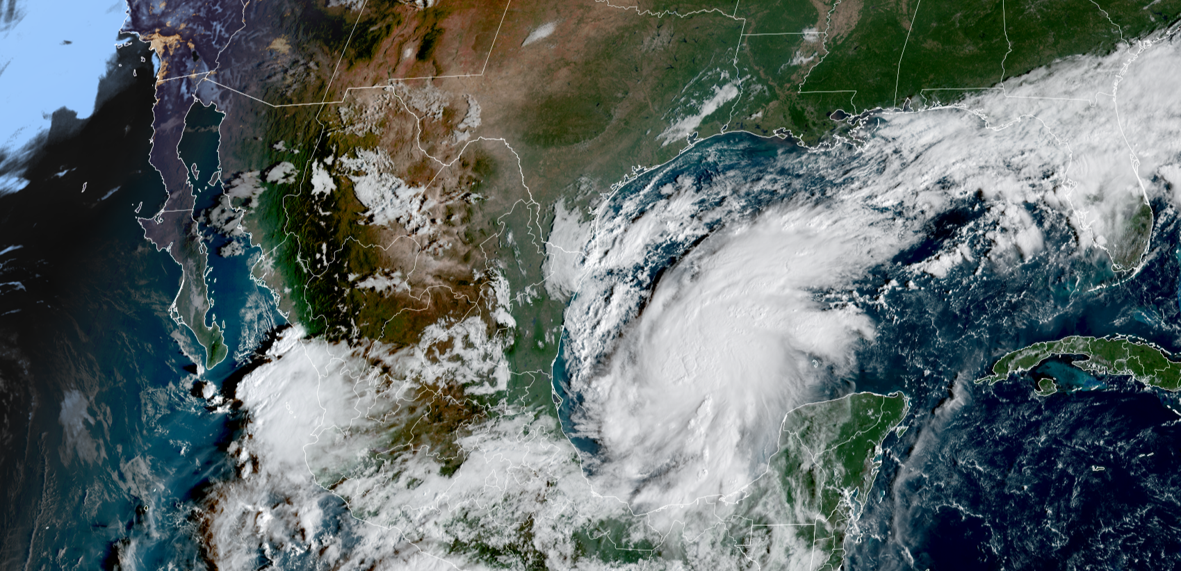
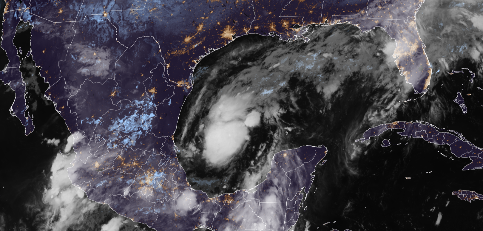
The disturbance we've been watching in the southwestern Gulf quickly wrapped up into Tropical Storm Isaias early today. The forecast from the National Hurricane Center and the consensus of the various computer model forecasts is that the storm will impact the northern Gulf Coast as a significant hurricane late Friday or early Saturday.
LATEST FROM FOX WEATHER HURRICANE SPECIALIST BRYAN NORCROSS
The exact landfall point is uncertain, but the storm surge, heavy rain, and tornado threat are likely to extend a long distance east of the center of circulation. Heavy rain will bring the threat of flooding to a large portion of the Southeast.
The change in the forecast from yesterday was due to a slight shift in the orientation of the jet stream across the south. The consensus now is that it will be far enough north to allow the storm to make landfall before the interaction with the strong upper winds completely disrupts the circulation.
Essentially, the jet stream is forecast to be close enough to energize the storm, but not so close that it injects dry air into the circulation so the storm quickly weakens before landfall.
The current thinking is that the system will start transitioning to a nor'easter-type storm due to its interaction with the jet stream just as it's nearing the coast. That transition process will spread the impacts well east of the center. West of the center, dry air will dominate.
TIMELINE: WHERE TROPICAL STORM ISAIAS IS HEADED AND WHEN IT COULD BECOME A HURRICANE
Likely-Hurricane Isaias is forecast to be at Category 2 strength offshore of the Gulf Coast but start weakening shortly before reaching land. Some computer forecasts, notably from Google DeepMind, predict that Isaias will peak at an even stronger intensity.
It's critical that everyone pay attention to the hurricane and storm surge alerts for their area when they are issued later today.
Isaias will die out over the Southeast but its impacts will linger into next week.
A rule of tropical storm and hurricane forecasts is that errors are much larger for developing or slow-moving systems. Isaias fits in both buckets. Expect adjustments to the landfall point and potentially to the forecast intensity as the storm organizes over the next couple days.
Note that throughout this season of El Niño-driven hostile conditions across the tropical Atlantic, we have pointed out that the Gulf and the waters east of Florida would be the prime spots that we would watch late in the season. And here we are.
Tropical Storm Simon is still expected to form from the disturbance off the Mexican coast. The system is forecast to parallel the coast until late Friday or early Saturday. About that time, a strong dip in the jet stream will dive south and should deflect likely-Simon toward the coastline. Everybody from Manzanillo north, including Puerto Vallarta and Cabo San Lucas, should follow the progress of likely-Simon.
Hurricane Rachel is puttering offshore of northern Mexico. It is also expected to be deflected back toward the coast, aiming at Baja California. It will be a weaker version of itself by then but may still be impactful.
Moisture from both of these systems will spread across northern Mexico and into the Southwest U.S. Rachel's moisture will also spread over Southern California as cooler weather arrives over the weekend.
What's Your Reaction?
 Like
0
Like
0
 Dislike
0
Dislike
0
 Love
0
Love
0
 Funny
0
Funny
0
 Angry
0
Angry
0
 Sad
0
Sad
0
 Wow
0
Wow
0