


Tropical storm alerts could be issued within hours in Texas as disturbance enters Gulf of America's warm water

There are increased odds of tropical development across the southern U.S. this week as the risk of heavy rain and flooding has communities on alert.
As of the latest update from the National Hurricane Center (NHC), the odds for tropical development have increased to 50% over the next seven days.
The system was designated as Invest 90L and is the first invest of the 2026 Atlantic hurricane season, according to the FOX Forecast Center.
WHAT IS AN INVEST DURING HURRICANE SEASON?
The term "invest" is used every hurricane season in the Atlantic, Eastern and Central Pacific basins, accompanied by a number from 90 to 99 and either the suffix "L," "E" or "C," respectively.
The main threat across the Gulf region will entail gusty coastal winds and tropical rain, which will bring the risk of flash flooding.
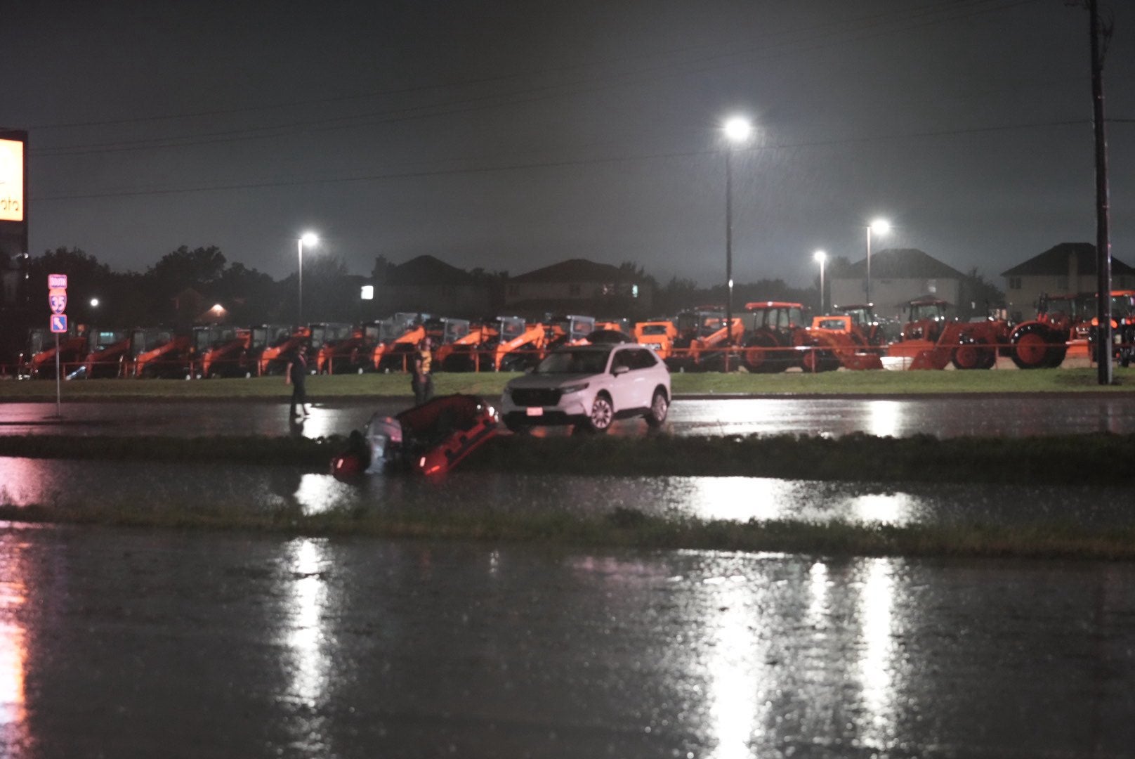
SEE IT: FIREFIGHTERS USE RESCUE BOATS TO SAVE 15 CAMPERS STRANDED IN FAST-RISING FLOODWATERS
According to the FOX Forecast Center, confidence in tropical development will increase over the next few days in the south, fueling a flash flood risk for millions across Texas to Georgia.
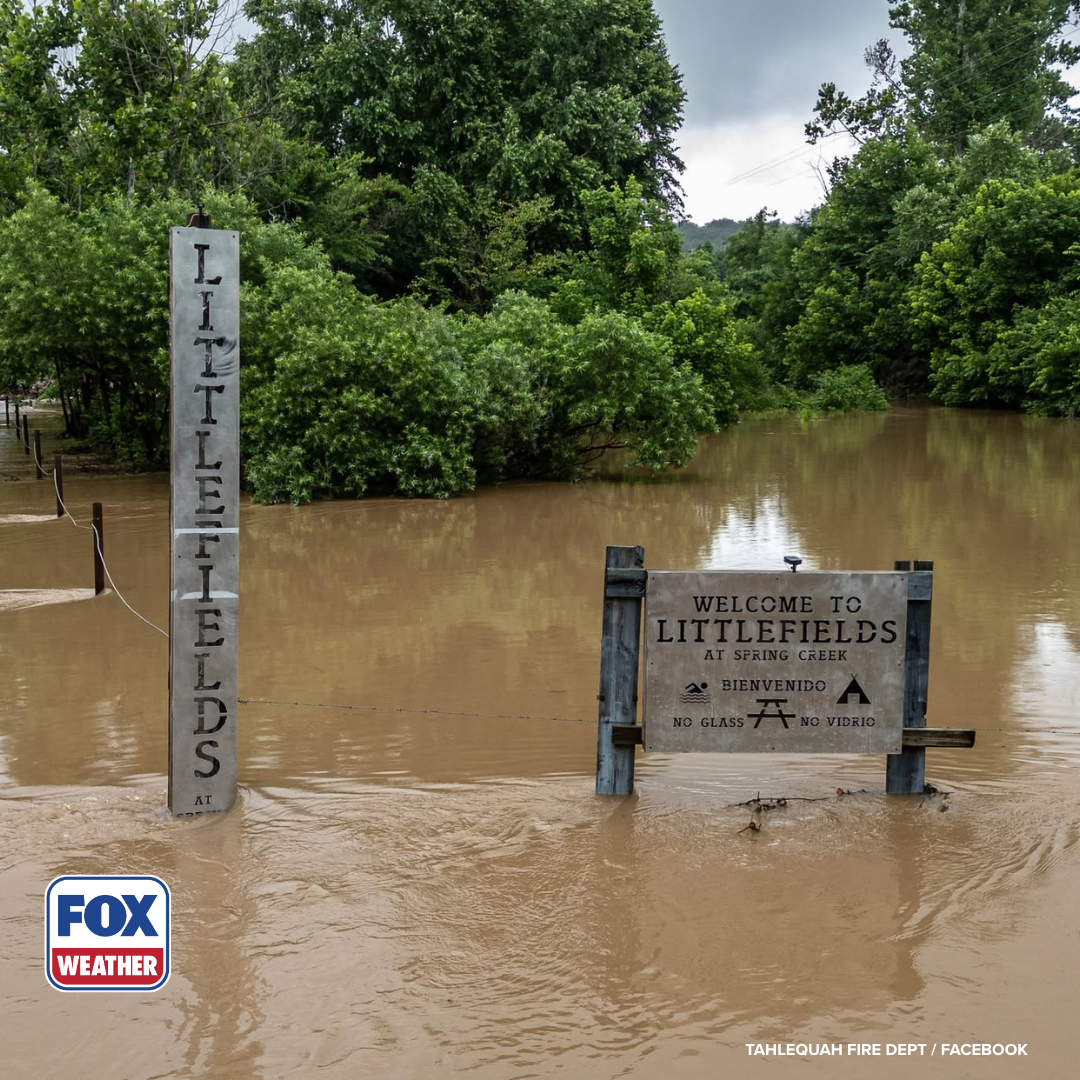
A Level 3 out of 4 flood threat has been issued each day through Thursday for various parts of the region, with widespread and locally catastrophic flooding expected over the coming days, according to the FOX Forecast Center.
Deep tropical moisture will linger northward and will combine with a strong cold front dropping south into the region.
As the front drifts southward, the FOX Forecast Center predicts it will come to a halt by midweek with daily showers and thunderstorms remaining before fizzling away.
As this occurs, an upper-level area of circulation will move out of northern Mexico, bringing moisture from the Gulf of America, which will result in slow-moving thunderstorms across states like Texas.
DEW POINT VS. HUMIDITY: WHICH ONE IS A BETTER MEASURE OF HOW MUGGY THE AIR FEELS?
Popular cities such as Houston, Corpus Christi, and Jackson, Mississippi, are all included in the second-highest flood risk at some point this week.
These locations could see rain totals of 5 to 8 inches through Tuesday, as the nasty weather is expected to last through mid-week.
Due to this, the NHC has placed an Area to Watch in the northwestern portion of the Gulf of America.
Houston and Corpus Christi are under a Level 3 out of 4 threat through Tuesday, as flood watches expand.
Despite this, forecasters are keeping an eye on the low chances of Tropical Storm Arthur developing, but a dangerous flash flood risk remains.
Depending on the track and timing of the potent area of circulation, forecasters may still be tracking flash flooding through Friday, as some models show the system moving south into next weekend.
SEE IT: FIREFIGHTERS USE RESCUE BOATS TO SAVE 15 CAMPERS STRANDED IN FAST-RISING FLOODWATERS
Stay tuned to FOX Weather as we continue to track this storm’s development.
What's Your Reaction?
 Like
0
Like
0
 Dislike
0
Dislike
0
 Love
0
Love
0
 Funny
0
Funny
0
 Angry
0
Angry
0
 Sad
0
Sad
0
 Wow
0
Wow
0