


Strong tornadoes threaten to slam Mississippi, Alabama as severe storms erupt across the Southeast
Another round of severe storms is taking shape Wednesday, with threats shifting into the Southeast — likely ending a rare two-month spring stretch without tornadoes in parts of the region.
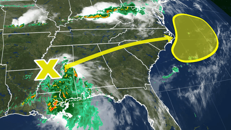
This has all been brought on by a massive cold front sprawling the nation.
TRIPLE THREAT: MASSIVE COLD FRONT TO UNLEASH SNOW, SEVERE STORMS AND HEAVY RAIN ACROSS 25+ STATES
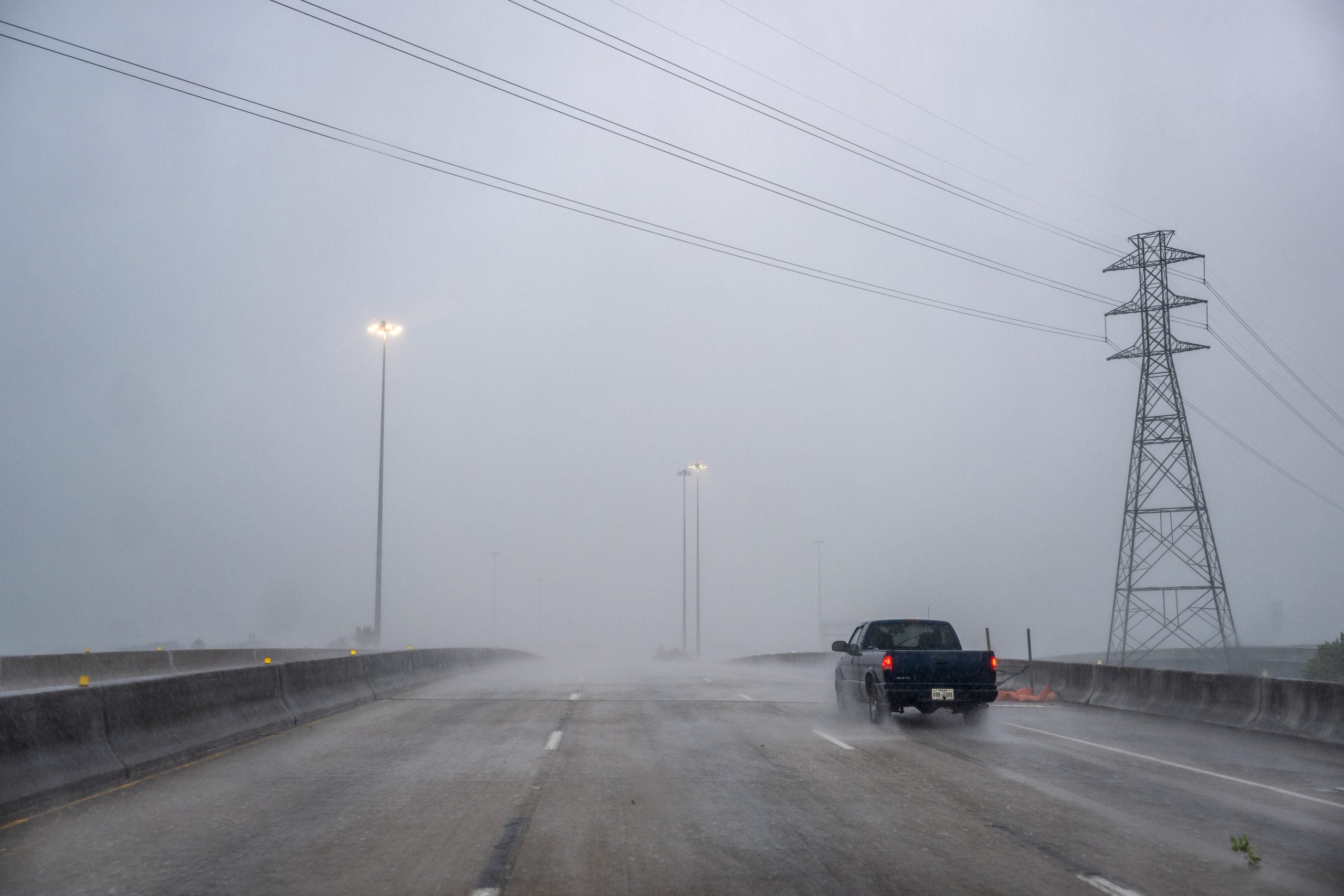
Numerous storms are set to slam the area, with the primary risk developing later in the day. Tornadoes and hail are possible, with damaging winds possibly continuing into the evening.
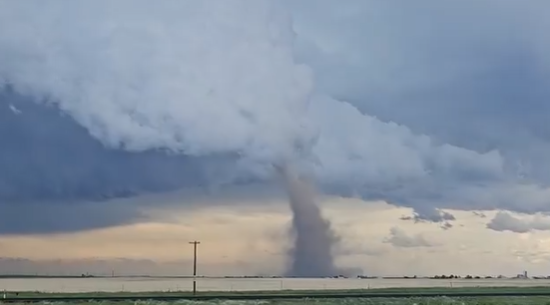
Parts of Mississippi and Alabama are under a Level 3 out of 5 severe threat, where strong tornadoes could develop late.
Continuing the multi-day severe weather threat, storms are possible early in the day across Tennessee and into northern Mississippi, Alabama and Georgia, possibly elevated due to an east-west outflow boundary.
The Fox Forecast Center said some gusty winds are possible with the early storms. However, the primary severe risk will develop during the late afternoon after 5 p.m. ET and into the early evening, as atmospheric energy builds.
The deep moist layer, combined with strong upper-level winds, should support supercells with a hail and tornado threat initially.
WHAT IS A SUPERCELL THUNDERSTORM?
The severe risk may persist into the evening in Georgia as the southwesterly low-level jet brings instability into that area.
Corridors of damaging winds may evolve as well.
That said, Georgia, Alabama, and Florida all recorded zero tornado warnings in April — an astonishing feat last seen in 2012. Wednesday’s threat marks the first tornado risk for Georgia and Alabama since March 15.
Additionally, this setup is expected to bring several days of rain too, with the heaviest downpours expected Wednesday in the South due to the slow movement of the front and the potential for training storms over the same areas.
A large Level 2 out of 4 flash flood risk is in place for a large portion of the Southeast. The rain will continue beyond Wednesday, where rain totals will generally mount up to 2 to 3 inches over a wide area.
Along with Wednesday’s severe weather threat across the Southeast, the massive cold front sweeping the nation is bringing broader impacts, including heavy rain to the Midwest and Northeast and an impactful snowstorm across the central Rockies.
What's Your Reaction?
 Like
0
Like
0
 Dislike
0
Dislike
0
 Love
0
Love
0
 Funny
0
Funny
0
 Angry
0
Angry
0
 Sad
0
Sad
0
 Wow
0
Wow
0