


.jpg)


Renewed storm threat to impact the Plains as severe weather impacts millions
More than 60 million people from southern Minnesota to parts of the South, including Arkansas, northern Mississippi and northern Alabama are in the path of dangerous severe weather that could leave a trail of destruction.
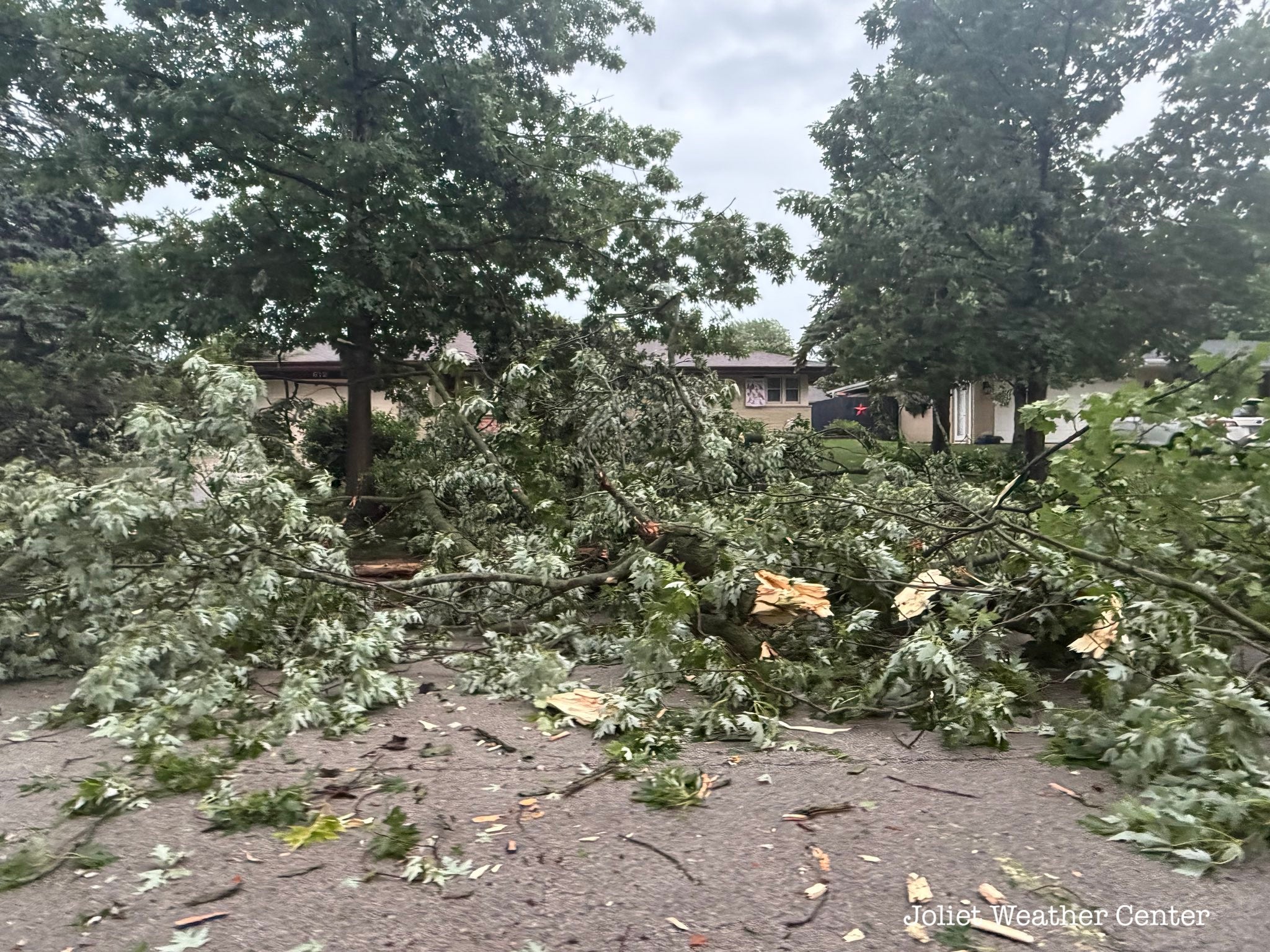
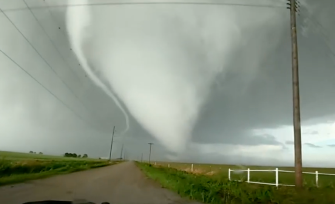
The first confirmed tornado of the evening was spotted in Sugar Creek, Illinois.
TORNADO SAFETY: THE SAFEST AREAS TO PROTECT YOURSELF AND WHY TO AVOID OVERPASSES
As the storm intensified, the National Weather Service issued a Particularly Dangerous Situation (PDS) as a second tornado moved toward Carlyle, Illinois.
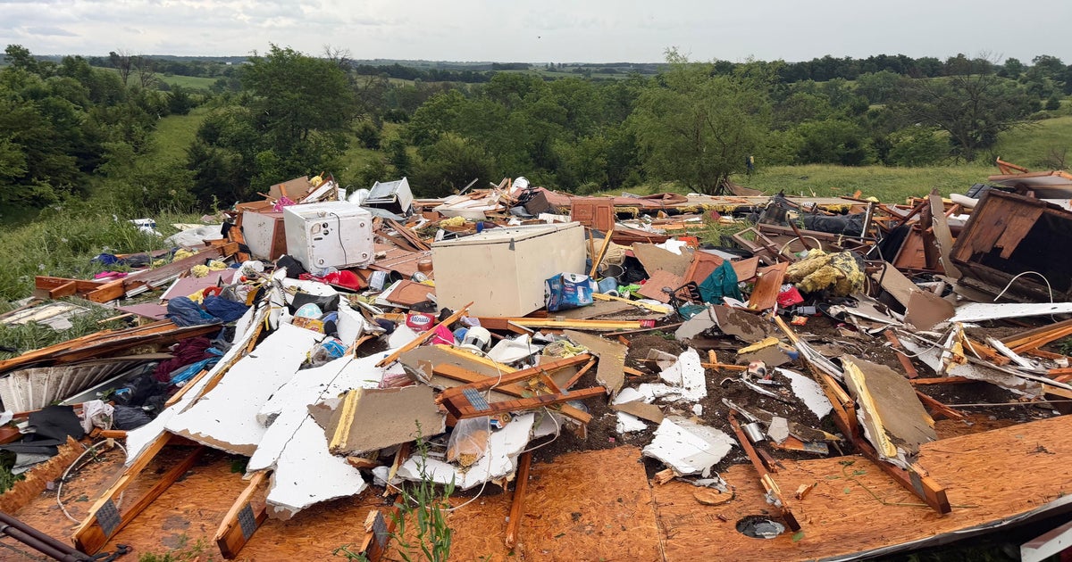
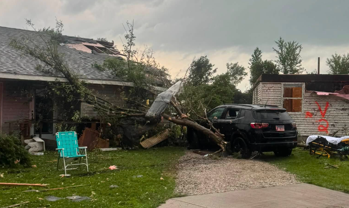
There are already reports of damage throughout the region.
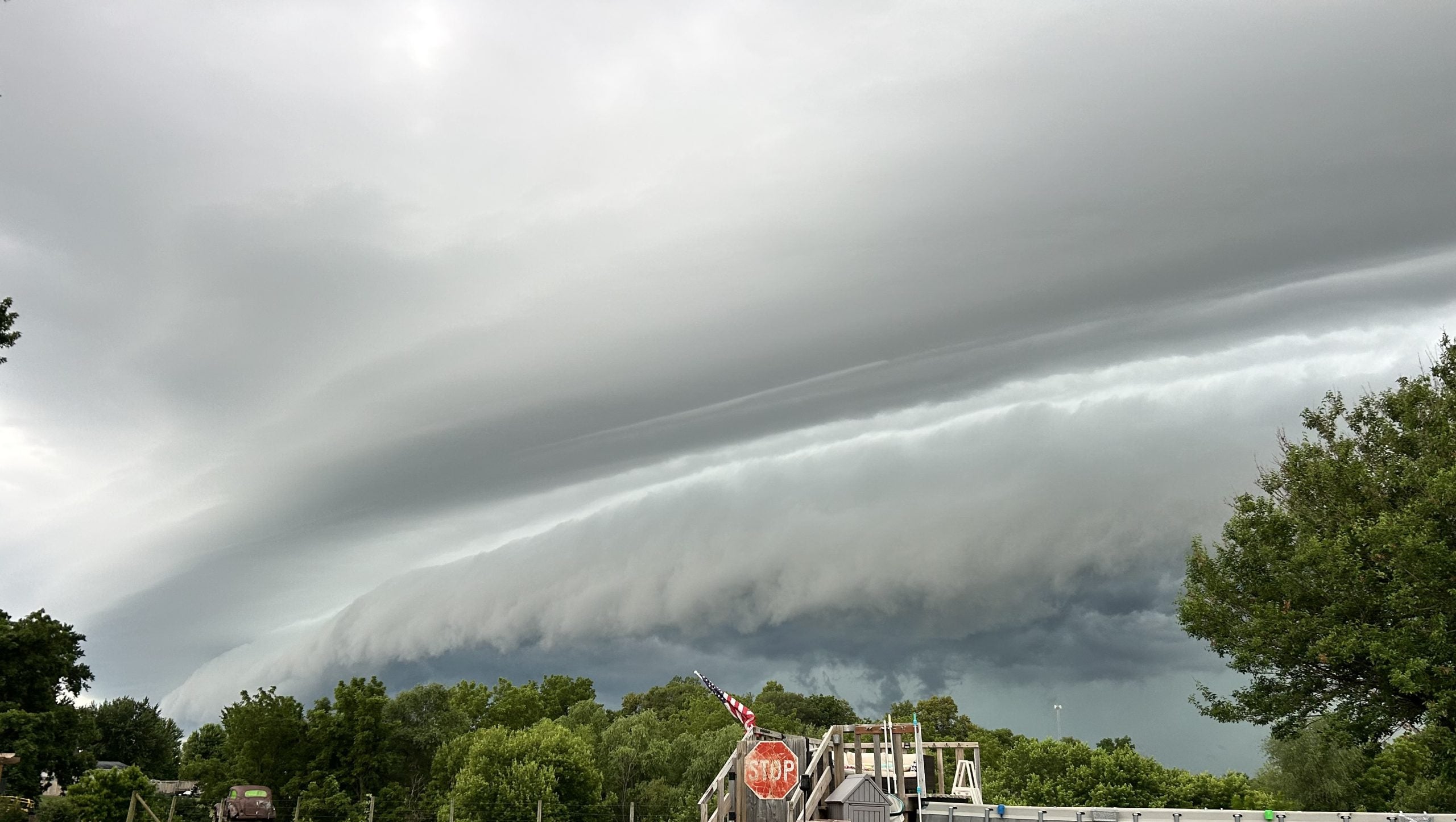
These storms come as a volatile atmosphere developed, supporting the potential for a severe weather outbreak.
This prompted the Storm Prediction Center to issue a Level 4 out of 5 severe weather risk for southeast Missouri and southwest Illinois.
Some major cities in the Level 4 threat zone included St. Louis; Cape Girardeau, Rolla and Poplar Bluff, Missouri; and Mount Vernon, Illinois.
SEE IT: DESTRUCTIVE STORMS SLAM TEXAS, LEAVING 2 DEAD AS SEVERE WEATHER SWEEPS REGION
However, the ongoing morning storms limited afternoon storm development. But there is increasing confidence in a corridor of undisturbed air that could support the development of potentially intense EF-3+ tornadoes later tonight.
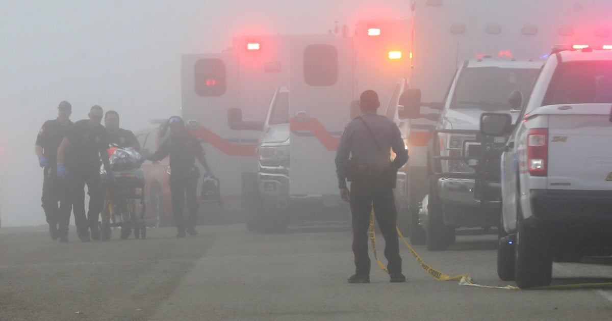
This is the latest severe weather threat in a relentless outbreak that began last Thursday, which produced a destructive EF-4 in Enid, Oklahoma, and twisters that killed at least two people in Runaway Bay, Texas late Saturday.
Sunday's severe weather threat produced large hail and damaging wind gusts across Kansas, Oklahoma and parts of North Texas.
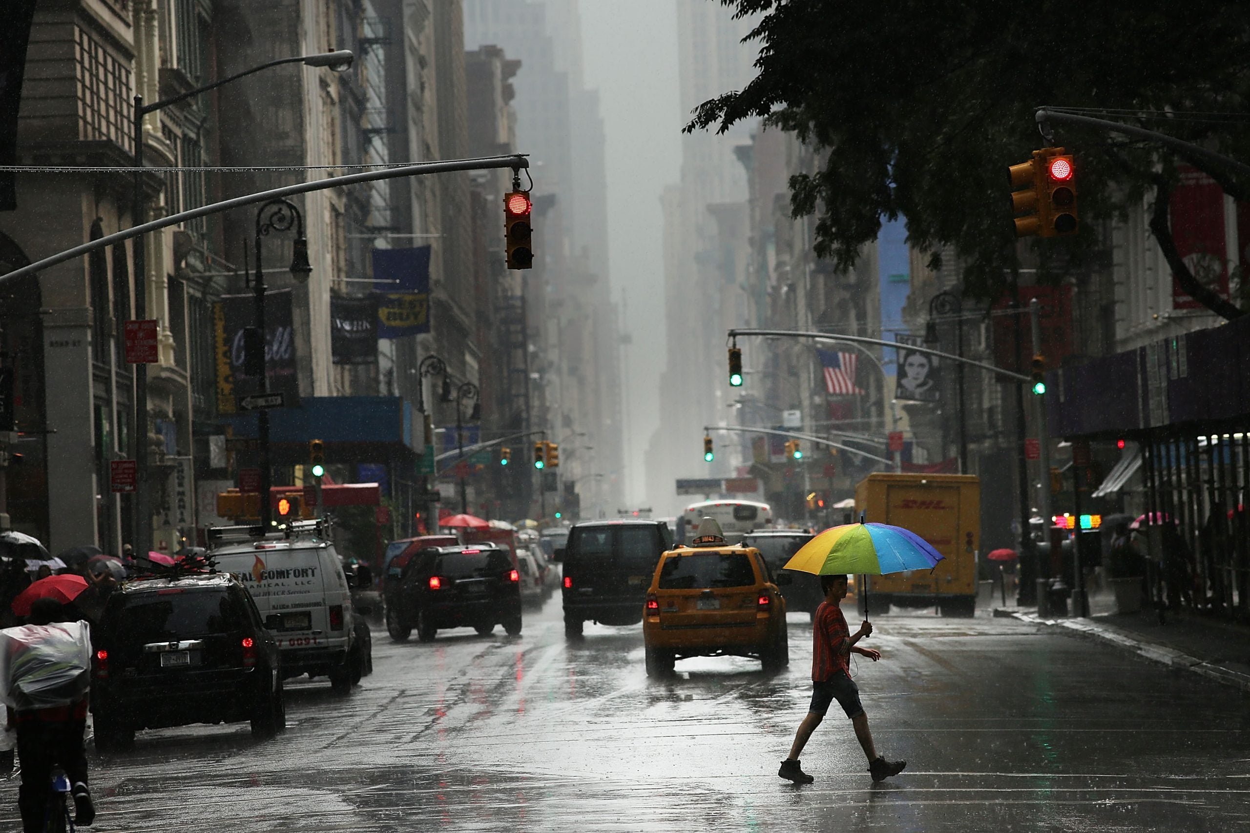
Severe thunderstorms started early Monday, blasting through the Central Plains and the Midwest. Quarter-sized hail, heavy rain and wind gusts up to 70 mph were recorded moving through Kansas City, Missouri. Strong storms also swept through St. Louis.
MUCH-NEEDED RAIN TARGETS THE SOUTH, YET WORST DROUGHT ZONES WILL MISS OUT
The heavy rain from these storms also produced flash flooding across parts of Kansas and Missouri, with a swath of 3 to 5 inches of total rainfall through Tuesday morning.
As the cloud cover cleared over the Midwest, the atmosphere reloaded, creating an even more dangerous severe weather threat Monday afternoon.
These were prime conditions for long-track potential tornadoes (EF-3+) across Missouri, Illinois, Indiana and western Kentucky. This included the St. Louis, Springfield, Illinois, Evansville, Indiana, and Paducah, Kentucky, metro areas.
But many of those areas steered clear of the strongest storms because of an atmospheric cap.
NOAA's Storm Prediction Center (SPC) issued a Level 3 out of 5 risk of severe thunderstorms for this corridor.
In addition to the potential for long-track tornadoes, there was a Level 4 out of 5 risk of wind gusts exceeding 80 mph across this same area.
TORNADO SAFETY: EVERYTHING YOU NEED TO KNOW ABOUT TAKING SHELTER DURING SEVERE WEATHER
A broader Level 2 threat covered parts of southern Wisconsin, eastern Iowa, northeastern Arkansas, and Middle Tennessee. Chicago, Indianapolis, Memphis and Nashville are all included.
Storms were expected to be the strongest through 10:30 p.m.
Tuesday's severe weather forecast is also dependent on how storms develop Monday, but storms are expected to fire in the afternoon primarily across the cold front that will be draped over the Lower Mississippi Valley including southern Missouri, Arkansas, Mississippi, northeastern Alabama and Tennessee.
DEADLY WILDFIRES RAGING ACROSS GEORGIA AND FLORIDA FUELED BY DRY CONDITIONS AND HISTORIC DROUGHT
A Level 3 threat stretches from northeast Texas into central Kentucky.
According to the FOX Forecast Center, some of these storms could become more organized and produce large hail, damaging winds and possibly a tornado or two.
As the day rolls on, more intense storms are forecast to erupt east of a dryline across Texas and on the south side of the cold front extending from Oklahoma into the Mississippi Valley.
This is the sixth-straight day with a level 3 risk or higher.
What's Your Reaction?
 Like
0
Like
0
 Dislike
0
Dislike
0
 Love
0
Love
0
 Funny
0
Funny
0
 Angry
0
Angry
0
 Sad
0
Sad
0
 Wow
0
Wow
0