


%2031.jpg)
Severe weather outbreak brewing with potential strong, long track tornadoes targeting millions in Midwest
More than 50 million Americans across the Midwest and Mississippi Valley are in the threat zone for a brewing severe weather outbreak expected to develop on Monday, with the potential for large hail, damaging winds, and tornadoes.
This comes after days of severe weather impacted the South and central U.S., resulting in numerous tornadoes, giant hail, and vicious winds.
LEVEL 4/5 RISK: GIANT HAIL, STRONG TORNADOES TARGET PLAINS AGAIN AS DANGEROUS SEVERE STORMS FIRE UP
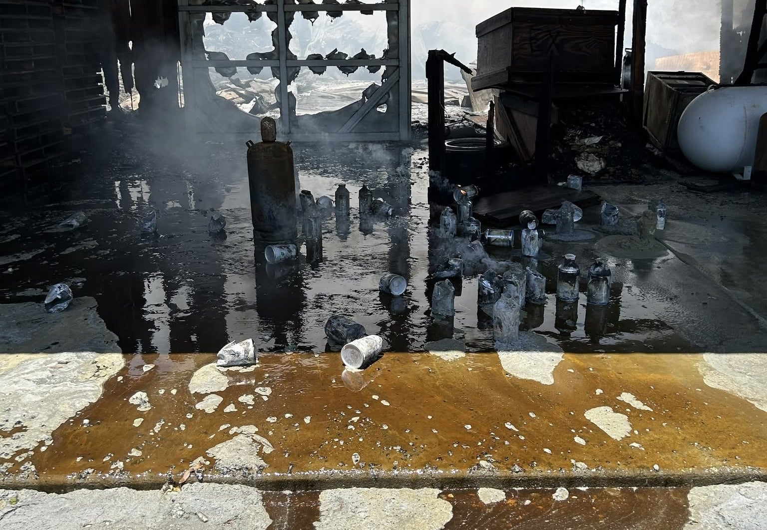
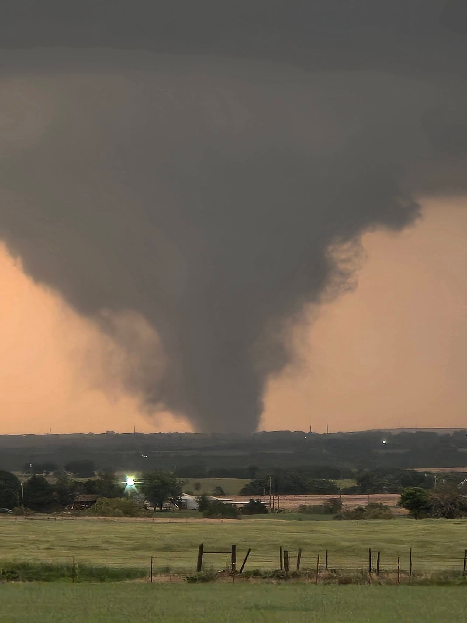
One confirmed, monstrous EF-4 tornado tore through Enid, Oklahoma, on Thursday evening, leaving a trail of destruction in its path.
Local officials reported significant damage on the city’s southern side, particularly in the Gray Ridge area. After the tornado passed, officials said some residents were trapped in homes and storm shelters.
Enid Mayor David Mason told FOX Weather on Friday that at least 40 homes were damaged in the Gray Ridge area.
"I am very grateful to report that while homes have sustained significant damage, there have been no fatalities and only minor injuries," Mason said.
According to the FOX Forecast Center, Monday’s outbreak could produce dangerous supercells capable of all severe hazards, like large hail, damaging winds, and strong tornadoes.
NOAA’s Storm Prediction Center (SPC) has issued a level 3 out of 5 risk of severe storm threat across parts of the Midwest and Mississippi Valley, including eight states such as Missouri, Wisconsin, and Iowa. Forecasters say St. Louis, MO could see some of the greatest impacts.
Meanwhile, a broader level 2 out of 5 risk stretches from the Central Plains through the Ohio Valley and into the Southeast, including major cities such as Chicago, Indianapolis, Memphis, and Little Rock.
The FOX Forecast Center says the severe weather outbreak is expected to develop Monday afternoon ahead of a cold front and dryline.
These storms will move into warm, moist,and unstable air, an environment that is perfect for severe weather to ignite.
At the same time, the system developing Sunday across the central Plains will quickly move towards the Northeast, pulling a surface low into the Upper Mississippi Valley.
SEVERE WEATHER EXTENDS INTO THE WEEKEND AS MILLIONS BRACE FOR 'MARATHON' THREAT
As this occurs, a warm front will rapidly form northward, fueled by a strong low-level jet stream, leading to widespread rainfall.
This may limit how far north the severe weather will develop.
Forecasters say the intensity of Monday's severe storms will depend on how Sunday's storms unfold.
If the storms are not as widespread across the Plains, more moisture and instability may stream into the Lower Mississippi Valley, potentially supporting a higher-end severe weather event on Monday.
SEE IT: DESTRUCTIVE TORNADOES RIP ACROSS NORTHERN OKLAHOMA, LEAVING WIDESPREAD DAMAGE IN THEIR PATH
Stay with FOX Weather for the latest all weekend long tracking these storms and Monday’s forecast.
What's Your Reaction?
 Like
0
Like
0
 Dislike
0
Dislike
0
 Love
0
Love
0
 Funny
0
Funny
0
 Angry
0
Angry
0
 Sad
0
Sad
0
 Wow
0
Wow
0