


%20052026%20SOURCE%20Tello.jpg)


One killed, evacuations issued from dangerous flash flooding in Northern California
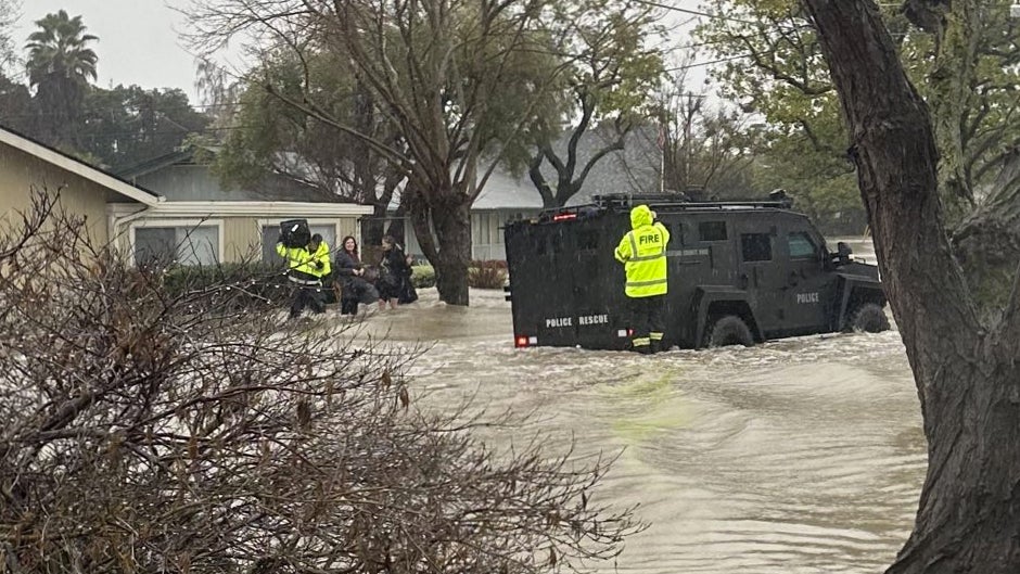
The mayor of Redding, CA announced on Sunday that one person had died from the life-threatening flooding that is impacting portions of Northern California.
Many roadways are also swamped with floodwaters, causing vehicles to be trapped. Evacuations and rescues are underway throughout the region.
The area is currently being slammed by heavy rounds of rain, snow and wind which is creating dangerous flash flooding throughout Northern California.
Travel headaches have already started as all flights have been halted at San Francisco International Airport. It is expected that other airports in California will be impacted, including Los Angeles International Airport, and Sacramento International Airport.
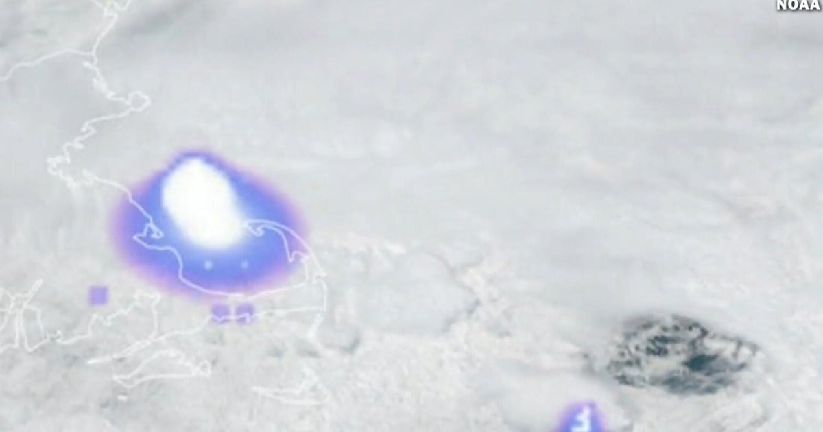
The activity began on Saturday as the next atmospheric river shifts south, positioning itself across Northern California. A strong area of low pressure moves into the Gulf of Alaska while high pressure over Southern California acts to funnel moisture from Hawaii—making this a classic "Pineapple Express."
Officals have said that some areas could see a month’s worth of rain, while others could see most of their yearly average in just a few short days.
With the surge of moisture aimed directly at the California coast, widespread rain is now likely across most of Northern California throughout the day today. Flash flooding is expected from the Napa Valley north to Chico. A Level 3 of 4 (Moderate) flash flood threat now exists for Northern California and the northern Sierra Nevada foothills.
CHRISTMAS WEATHER OUTLOOK: NICE WITH A TOUCH OF NAUGHTY ACROSS THE U.S.
Further south, a Level 2 of 4 (Slight) threat includes major cities like San Francisco and Sacramento. Flood watches have already been issued for most of Northern California through at least Friday.
Widespread totals of 3 to 5 inches of rain are expected across Northern California, including coastal regions. Higher totals are forecast for the northern Sierra Nevada foothills, where 5 to 8 inches are possible, with some isolated areas reaching up to 10 inches by Tuesday. Debris flows in recent burn scars are a distinct possibility, but river flooding will be more widespread, especially near the California coast.
The snow-starved Sierra Nevada will finally see impactful snowfall, allowing ski resorts to thrive this season. Coastal impacts are also likely starting Tuesday into Wednesday, with wind gusts as high as 80 mph possible.
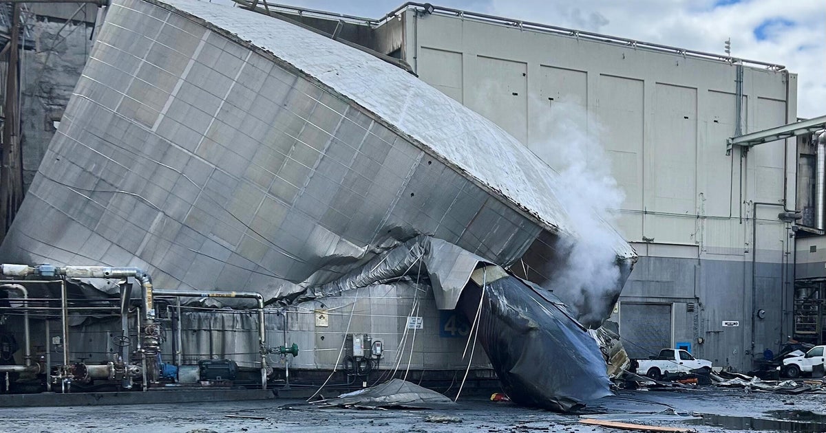
From Tuesday night into Wednesday, a second round of flooding rain and powerful winds will move onshore in Northern California. This storm is expected to intensify as it moves inland, bringing wind gusts up to 80 mph to coastal areas and the potential for even more flooding, according to the FOX Forecast Center.
Some forecast models indicate this system could become a bomb cyclone as it approaches the coast early Wednesday morning. Flash flooding remains a threat across most of Northern California as additional heavy rain impacts the region. National Weather Service San Francisco has advised locals and tourists to stay away from the Pacific coast as the storm moves in.
Moisture will also shift south during this second round. Rain is expected to move down the coast through Central and Southern California into Christmas Eve and Christmas Day, significantly impacting holiday travel along the I-5 corridor.
WHAT YOU NEED TO KNOW ABOUT THE WINTER SOLSTICE
If Los Angeles receives over 3.82 inches, it would mark the wettest two-day Christmas Eve/Day period on record. A final round of moisture is expected to move through the state late Thursday into the weekend. With soils already saturated from nearly a week of rain, the risk of flash flooding will be significantly increased.
There is a silver lining for the mountains: snow levels are expected to drop to pass levels (5,000–6,000 feet) approaching Christmas Eve. While this will cause major travel impacts, it is much-needed relief for the Sierra Nevada, which is currently sitting well below average—northern zones are at just 5% of their normal snowpack, while southern regions are closer to 40%. Heavy snow is also likely across portions of the Rockies as moisture spills into the Intermountain West.
What's Your Reaction?
 Like
0
Like
0
 Dislike
0
Dislike
0
 Love
0
Love
0
 Funny
0
Funny
0
 Angry
0
Angry
0
 Sad
0
Sad
0
 Wow
0
Wow
0