


%20052026%20SOURCE%20Tello.jpg)


Looking back: Extreme weather and disasters that made 2025 a year to remember
In 2025, extreme weather and natural disasters delivered earth-shattering, heart-stopping moments that were chronicled on FOX Weather, as they happened.
Each month packed a punch in a unique way. Records were shattered, droughts ended, and the sky was illuminated in an unforgettable year.
Here's a look back at some memorable weather moments from each month, from January to December.
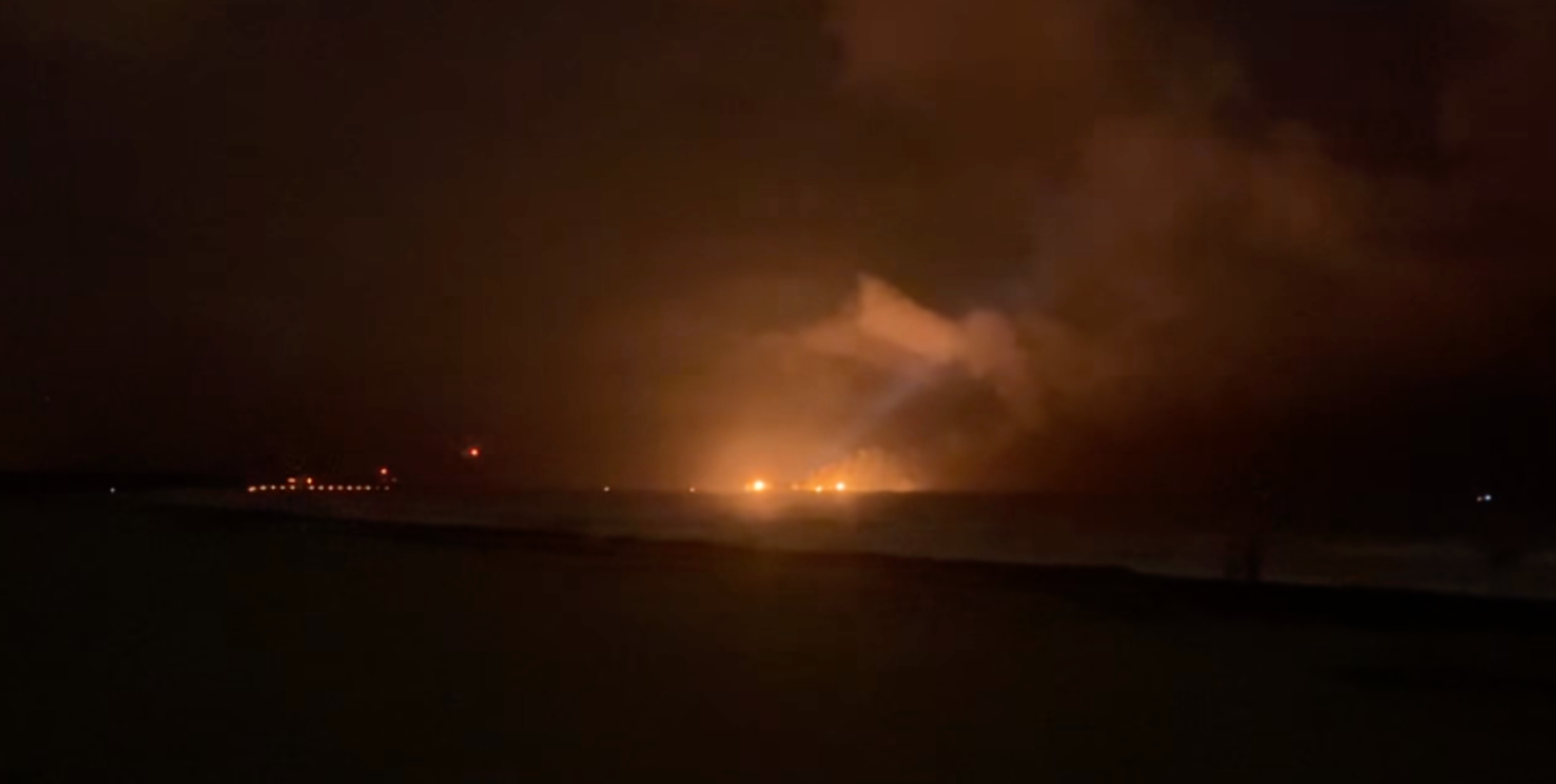
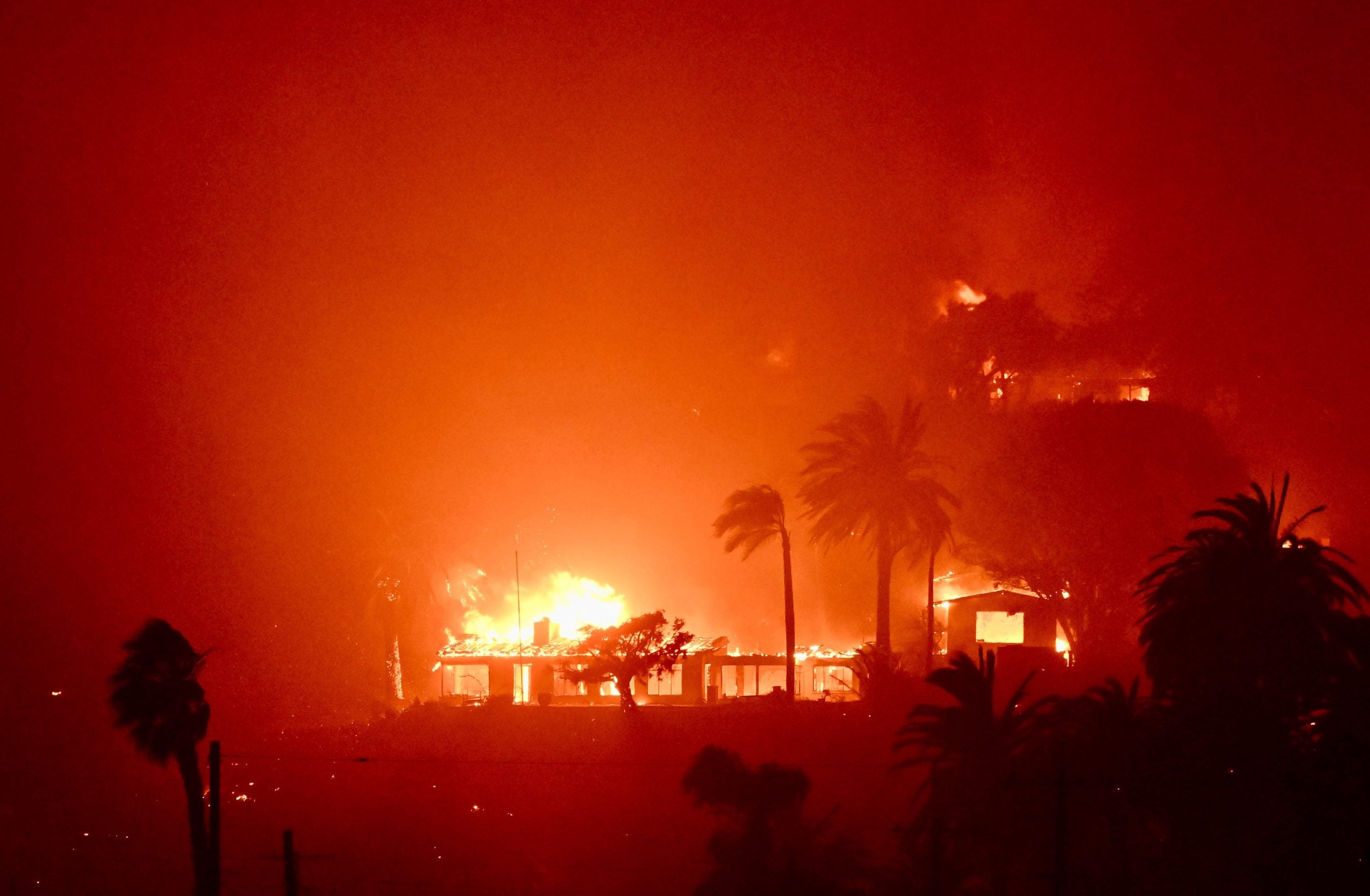
The year started off hot when much of Southern California was engulfed in flames in the historic fires that spanned across the month of January.
A YEAR IN REVIEW: THE MOST DRAMATIC VOLCANIC ERUPTIONS IN 2025
More than 16,000 homes and businesses were destroyed and tens of thousands of acres were scorched in the multitude of fires.
The fires rapidly spread through densely populated neighborhoods due to extreme winds raging at up to 100 miles per hour.
While the eyes of the world were on California during the historic wildfires that raged through the month and destroyed thousands of homes and businesses, the first-ever Blizzard Warning was issued along the Gulf Coast when a deadly winter storm slammed Texas.
Snow totals ranged from about 2 to 4 inches across the greater Houston area.
According to the National Weather Service (NWS), the William P. Hobby Airport picked up 3 inches of snow on Jan. 20, making it the most snow in one day since Jan. 30, 1949.
Several fatalities were reported in the region's rare bout of wintry weather.
New Orleans shattered its snow total record on Jan. 21 when near blizzard conditions slammed southeast Louisiana during a major winter storm.
SNOW BLANKETS NEW ORLEANS DURING HISTORIC GULF COAST WINTER STORM
The single-day snow total record was also shattered when Louis Armstrong New Orleans International Airport recorded 8 inches of snow, breaking the previous record set on Dec. 31, 1963 with a record of 2.7 inches.
The storm prompted the National Weather Service to issue the first-ever Blizzard Warning for southwest Louisiana and southeast Texas.
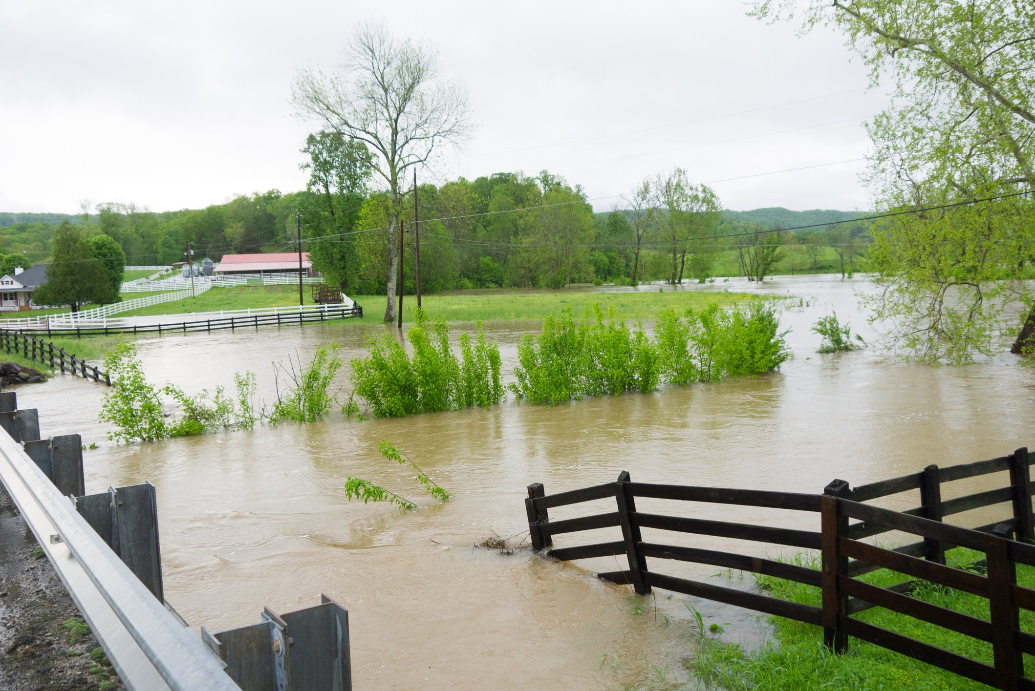
A historic flooding event spanning from Virginia to Kentucky unfolded on the weekend of Feb. 15 when a powerful storm system brought numerous threats to the eastern half of the U.S.
The catastrophic flooding left nine people dead in Kentucky, and included a levee failure in Tennessee.
Numerous high-water rescues were performed across the affected states to help those trapped by rising and raging floodwaters.
At least 43 people died across eight states in a massive outbreak that sent over 100 tornadoes across the South and America's Heartland, including three dangerous EF-4 tornadoes across a three-day period in mid-March.
From March 13 to 16, at least 26 EF-2 tornadoes and 34 EF-1 tornadoes also touched down during the severe weather outbreak.
WHAT IS THE DIFFERENCE BETWEEN A TORNADO WATCH, TORNADO WARNING AND TORNADO EMERGENCY?
According to a natural catastrophe report, the historic outbreak caused an estimated $11 billion in damage.
April kicked off with a relentless montage of tornadoes and historic flash flooding across the Mississippi Valley, Ohio Valley and parts of the south starting April 2.
At least 24 people died in Kentucky, Missouri, Indiana, Arkansas, Mississippi and Georgia, with a majority of the deaths occurring in Tennessee.
Heavy rain triggered flash flooding that plagued much of the affected region, including in Jacksonport, Arkansas, where FOX Weather Storm Specialist Mike Seidel reported live on scene.
Unpredictable severe weather and tornadoes continued across the U.S. through May.
HOW LONG DO TORNADOES LAST AND HOW DO THEY FORM?
On May 16, a powerful EF-3 tornado raged through the St. Louis Area in Missouri, killing at least seven people.
Drone shots captured extensive damage to a neighborhood that fell victim to the relentless tornado.
On June 20, a powerful derecho produced a deadly tornado that ran rampant across North Dakota, leaving behind a trail of destruction.
Three people were killed when a tornado swept through the rural town of Enderlin, North Dakota just after 11 p.m., officials said.
NORTH DAKOTA TORNADO OUTBREAK SETS NEW YEARLY TORNADO RECORD
Initial damage surveys gave the tornado a preliminary rating of EF-3 or stronger on the Enhanced Fujita Scale.
It wasn't until three months later in October that National Weather Service officials completed additional analysis and rated the deadly tornado an EF-5, the strongest on the tornado rating scale.
HOW ARE TORNADOES RATED? THE ENHANCED FUJITA SCALE EXPLAINED
The tornado ended a more than 12-year drought and marked the first EF-5 tornado in the U.S. since May 20, 2013, in Moore, Oklahoma.
According to the NWS assessment, the Enderlin tornado's estimated wind speed was greater than 210 mph. The forceful tornado even caused a train to derail, tossing one empty tanker approximately 475 feet.
The eyes of the nation were on Texas on the Fourth of July when devastating flash flooding tragically left more than 100 people dead across the Texas Hill Country.
TORRENTIAL RAIN TRIGGERS FLASH FLOOD EMERGENCY IN TEXAS HILL COUNTRY, DALLAS SETS RAINFALL RECORD
Record-breaking rainfall triggered the deadly flash flooding, and an ensuing wall of water that surged through the Guadalupe River that rose over 20 feet in just a few hours.
According to NASA, the catastrophic flash flood is the sixth-deadliest fresh water flood in U.S. history.
Camp Mystic, the all-girls Christian camp located along the river in the Kerr County town of Hunt, was in the direct path of the historic flooding. Tragically, 27 campers and one camp counselor died when the river had risen even higher than the areas mapped as a 500-year flood event.
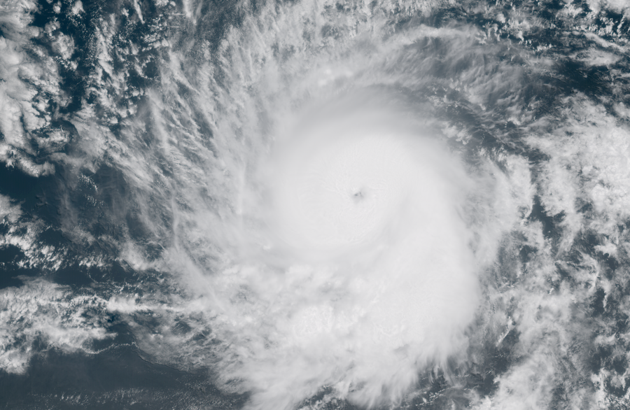
Hurricane Erin became the first major hurricane of the 2025 season in August, and strengthened from a Category 1 hurricane to a catastrophic Category 5 hurricane with winds of 160 mph in a matter of hours on Aug. 16.
Hurricane Erin delivered significant swell and caused coastal flooding along the East Coast.
HURRICANE ERIN'S HIGH TIDES IMPACT SEA TURTLE NESTS ALONG EAST COAST BEACHES
On Aug. 25, an epic dust storm, known as a haboob, swept across the Phoenix area in Arizona and knocked out power for thousands of utility customers, causing travel chaos as damaging winds ripped across the region.
The dust storm took over the Phoenix Metro Area, engulfing entire neighborhoods, an airport and a college football stadium, with reported winds between 50 and 65 mph and visibility just ¼ of a mile, according to the NWS.
Hot off the heels of Hurricane Gabrielle, in late September, Hurricane Humberto and Tropical Storm Imelda danced in the tropics that woke up in September.
The 2025 hurricane season produced 13 named storms, with five hurricanes and four storms marked Category 3 or higher on the Saffir-Simpson Hurricane Wind Scale.
HOW ARE HURRICANES RATED? THE SAFFIR-SIMPSON HURRICANE WIND SCALE EXPLAINED
For the first time since 2015, not a single hurricane made landfall in the U.S.
October produced one of the strongest hurricanes to make landfall on record, when Hurricane Melissa made landfall near New Hope, Jamaica, on Oct. 28, packing wind speeds of 185 mph.
The storm caused extensive damage and devastated western Jamaica, where FOX Weather Field Correspondent Robert Ray was on scene to capture the immediate recovery from the historic storm.
DRONE VIDEO SHOWS CATASTROPHIC DAMAGE TO JAMAICA STADIUM, NEIGHBORHOOD AFTER HURRICANE MELISSA
The Category 5 hurricane killed over 30 people in Jamaica and Haiti, and has set the stage for a long recovery process for the Caribbean island nation.
According to the World Bank Group, physical damages in Jamaica are estimated at $8.8 billion, making it the costliest storm in Jamaica's history.
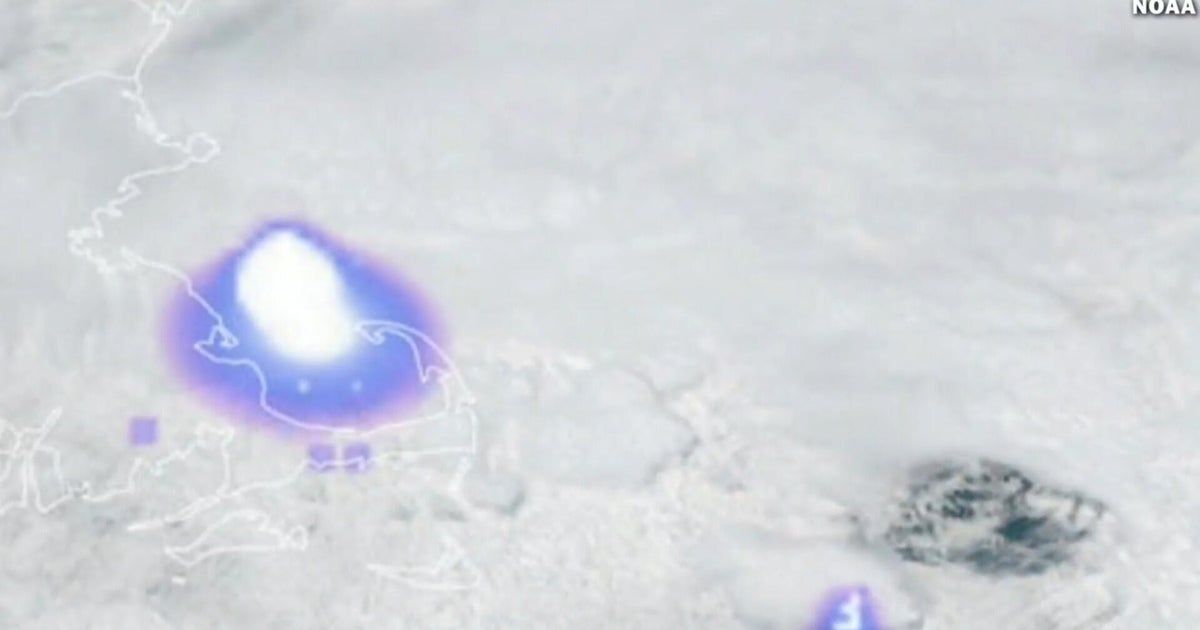
A powerful geomagnetic storm produced vibrant Northern Lights in the strongest solar flare of the year.
Dazzling aurora borealis displays were observed across the Northern Tier of the Lower 48 and beyond.
'SEVERE' GEOMAGNETIC STORM PRODUCES NORTHERN LIGHTS OVER LOWER 48
The strength of the storm allowed states like North Carolina, which normally don't see the aurora, to enjoy the light show.
7 THINGS TO KNOW ABOUT THE NORTHERN LIGHTS
Stunning aurora displays were shared across social media platforms, and were visible with a camera lens as far south as Oklahoma.
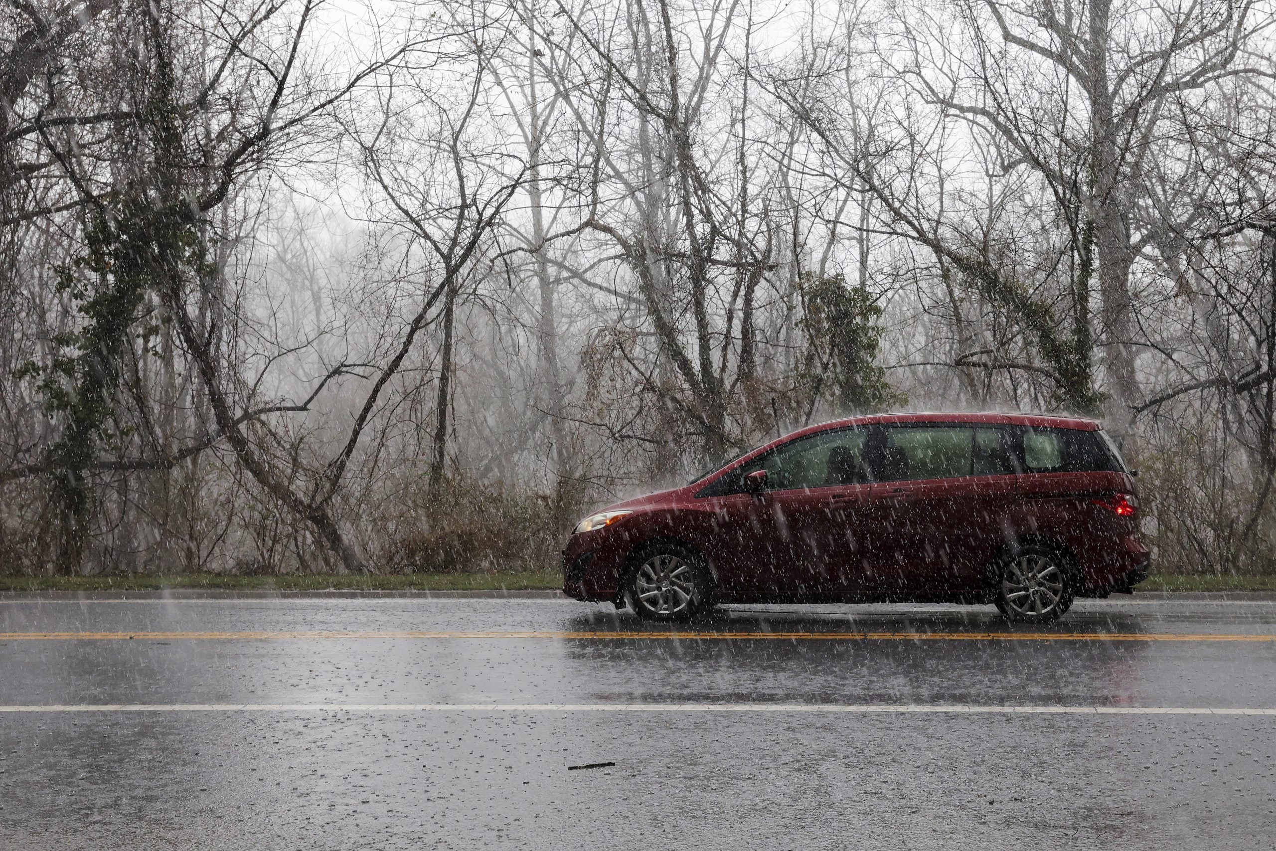
December has been an active weather season on both the East and the West coast.
On Christmas Eve, rounds of rain slammed the Los Angeles Metro Area on what was the wettest Christmas Eve on record at Los Angeles International Airport.
Widespread Flash Flood Warnings were issued across the Los Angeles metro area and other parts of Southern California, when the powerful Christmas Eve storm triggered mudslides and emergency evacuations across the region.
In the days after Christmas, a powerful winter storm blanketed the Northeast, bringing the highest snow totals to Central Park in New York City in over three years.
The snow didn't stop there. To wrap up 2025, a massive lake-effect snowstorm dumped feet of snow on parts of the Northeast, bringing feet to cities like Syracuse.
What's Your Reaction?
 Like
0
Like
0
 Dislike
0
Dislike
0
 Love
0
Love
0
 Funny
0
Funny
0
 Angry
0
Angry
0
 Sad
0
Sad
0
 Wow
0
Wow
0