
















Severe weather outbreak targets millions across 1,000+ miles with violent tornadoes possible in Central Plains

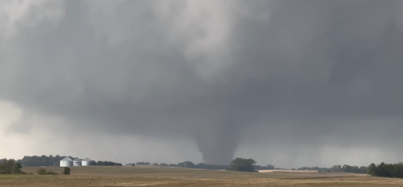
NOAA's Storm Prediction Center has issued a rare Level 4 out of 5 risk of severe thunderstorms for parts of Kansas and southeastern Nebraska, with violent EF-3+ tornadoes being the main threat. While parts of the Central Plains and the Midwest are in the bull's-eye of storms that are expected to fire beginning early Monday afternoon, a broader severe weather threat covers more than 80 million people across a 1,000-mile corridor from North Texas to western New York.
WHAT TO DO IF YOU'RE DRIVING DURING A TORNADO
This potential outbreak follows severe weather that barreled through the Central Plains and Midwest over the weekend that produced several tornadoes, including a Tornado Emergency in Nebraska, as well as large hail and damaging wind gusts.
LIVE UPDATES: DANGEROUS SEVERE WEATHER OUTBREAK THREATENS MILLIONS
The highest risk of tornadoes will be early-to-mid Monday afternoon, as severe weather first develops, likely after 2 p.m. CT.
Supercell thunderstorms capable of generating violent, long-track tornadoes (EF-3+) and softball-sized hail will be possible across Central and northeastern Kansas, including Wichita.
However, if thunderstorms form as a group instead of lone supercells it would limit twister intensity and development.
The FOX Forecast Center also highlighted cool air left behind by morning rain as a factor that could limit the intensity of storms Monday afternoon.
While tornadoes will still be possible, the threat is expected to decrease into the evening.
A broader Level 3 threat extends into central Iowa, northwestern Missouri and northern Oklahoma.
By nighttime, storms are expected to organize into a line and damaging wind gusts up to 75 mph will become the main hazard.
Across parts of the Upper Midwest and Great Lakes, storms will fire along a cold front beginning Monday afternoon and lasting through the evening.
Damaging wind, hail and heavy rain are expected to be the main threat and could cause localized power outages.
A broad Level 2 threat includes parts of Wisconsin, Illinois, Indiana and Michigan, including the Milwaukee and Chicago metro areas.
Severe storms are expected to persist into the overnight hours Tuesday as a wall of heavy rain and strong winds that will impact at least a dozen states.
Across the Southern Plains, the primary threat will be from any supercells that are able to form in the afternoon. A Level 2 threat covers most of Oklahoma and parts of North Texas.
As storms continue into Tuesday, severe storms will expand into the Ohio Valley, where a Level 2 threat has been issued.
Tuesday's storms will pack widespread 1–2 inches of rain from Northern Minnesota through northeastern Texas, where a minor risk of flash flooding is possible as well as these storms push east.
The multi-day severe weather threat wraps up by the end of Tuesday, before the wet weather returns for millions of Americans headed into Memorial Day weekend.
What's Your Reaction?
 Like
0
Like
0
 Dislike
0
Dislike
0
 Love
0
Love
0
 Funny
0
Funny
0
 Angry
0
Angry
0
 Sad
0
Sad
0
 Wow
0
Wow
0