


%20top%20art%20052026%20SOURCE%20Lauf%20Cycles.jpg)


Severe weather extends into the weekend as millions brace for 'marathon' threat

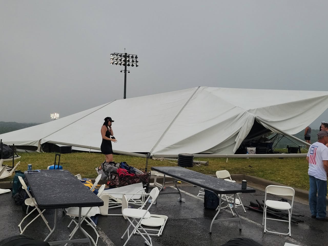
A turbulent Thursday was just the beginning of what forecasts are suggesting is a "marathon" of severe storms forecast to put over 40 million in the U.S. under threat of tornadoes, hail and damaging wind by Monday.
A line of severe storms, dipping from the Southern Plains into the Midwest began Thursday, triggering numerous tornadoes, one of which triggered a Tornado Emergency near Enid, Oklahoma.
WHAT IS THE DIFFERENCE BETWEEN A TORNADO WATCH, TORNADO WARNING AND TORNADO EMERGENCY?
FOX Weather Exclusive Storm Trackers Brandon Copic and Corey Gerken intercepted two tornadoes at the same time in Oklahoma live on air Thursday night.
The marathon of severe weather forecast to impact millions in the U.S. is just getting started.
On Friday, the severe storm threat shifts towards the Mississippi Valley on Friday, placing more than 35 million people at risk.
With ample instability and wind shear, the ingredients for severe storms set the stage for yet another day of severe weather.
By Friday afternoon, atmospheric instability is expected to increase from central and eastern Texas into Arkansas and Mississippi. Coupled with moderate wind shear across the region, this environment should support the development of organized storm clusters.
A Level 2 of 5 severe storm risk remains in place for parts of Texas, Oklahoma, Arkansas, Louisiana and Mississippi on Friday, including several cities at risk, such as Shreveport, Little Rock and Jackson.
Initial storm development across eastern Oklahoma and Arkansas will pose a large hail and damaging wind threat, as low-level shear remains generally weak, though a brief tornado or two will still be possible.
As storms evolve into the evening, one or more mesoscale convective systems may develop and move east-southeast into northern Louisiana and central Mississippi.
WHAT IS A DRYLINE AND WHY IS ITS LOCATION IMPORTANT IN SEVERE WEATHER FORECASTING?
Farther west, across central and eastern Texas, isolated convection along a dryline may allow storms to develop, posing a large hail risk.
Due to heavy rain over these regions and high rainfall rates, isolated areas of flash flooding are possible, with a Level 1 of 4 flash flood risk across Arkansas.
Widespread rainfall totals of 1 to 2 inches are expected through early Saturday.
Into Saturday, severe storms are expected to continue and increase in intensity as another area of low pressure moves into the Southern Plains.
HOW HIGH PRESSURE AND LOW PRESSURE DRIVE THE WEATHER
A Level 3 of 5 severe storm risk exists across portions of southern Kansas and northern Oklahoma, including Wichita and Tulsa.
After a slow morning, storms are expected to pick back up and develop along a lifting warm front and dryline.
WHAT IS A SUPERCELL THUNDERSTORM?
A highly unstable environment will initially support supercell development, with these storms eventually growing into a line capable of producing all severe hazards, including tornadoes.
Sunday’s forecast remains uncertain, with questions lingering about whether severe storms will extend the multi-day stretch.
Another system is forecast to develop across the Plains, with a sharp dryline extending south into Oklahoma.
WHERE IS TORNADO ALLEY? EVERYTHING TO KNOW ABOUT THE AMERICAN TWISTER HOTBED
Strong southerly winds ahead of this dryline will transport high levels of moisture northward, combining with very strong instability and wind shear.
A Level 3 of 5 severe storm risk is already in place from central Oklahoma into southern Kansas, including Oklahoma City and Wichita.
According to the FOX Forecast Center, there may be a strong cap in place preventing severe storms from developing until much later in the day.
DEVASTATING DAMAGE REPORTED ACROSS MULTIPLE STATES AFTER TORNADO OUTBREAK HAMMERS THE MIDWEST
Given the atmospheric conditions, a potentially significant severe weather episode remains possible by late Sunday afternoon, continuing through the evening, threatening large hail, damaging winds and tornadoes.
All threats are on the table on Monday.
Monday's severe storm potential will depend on how Sunday unfolds.
WHAT IS A 'TORNADO EMERGENCY'?
If severe storms are not widespread across the Plains on Sunday, greater moisture and instability may stream into the Lower Mississippi Valley, potentially supporting a higher-end severe weather event.
By Monday, the storm system will race northeast from the Central Plains into the Upper Mississippi Valley, pulling its surface low along with it.
A warm front will surge north, driven by a strong low-level jet, bringing widespread rain that may limit how far north severe storms can develop Monday afternoon.
Farther south, conditions look more concerning. Storms are expected to develop along and ahead of a cold front and dryline, moving into a warm, moisture-rich and increasingly unstable atmosphere favorable for strong thunderstorms.
TORNADO SAFETY: THE SAFEST AREAS TO PROTECT YOURSELF AND WHY TO AVOID OVERPASSES
A Level 3 of 5 severe storm risk is in place across the mid-Mississippi Valley, including St. Louis and Paducah, with a broader Level 2 of 5 risk extending from southern Wisconsin to northern Louisiana.
Beyond Monday, the potential for this multi-day severe weather stretch to continue into the Southeast and Southern Plains remains real.
With several days to go—and a complex setup ahead—there is still uncertainty around where severe storms will ultimately develop.
Repeated rounds of rain over the same areas will also raise flash flooding concerns.
Widespread totals of 2 to 3 inches are expected through Tuesday from Missouri to Georgia, with localized amounts of 3 to 5 inches or more possible across Mississippi, Alabama and Tennessee.
Stick with FOX Weather as we continue to track the threat in real time, and forecast what's to come.
What's Your Reaction?
 Like
0
Like
0
 Dislike
0
Dislike
0
 Love
0
Love
0
 Funny
0
Funny
0
 Angry
0
Angry
0
 Sad
0
Sad
0
 Wow
0
Wow
0