


Severe storms reload across Plains with renewed threats of large hail and tornadoes late this week
Severe storms will once again plague portions of the Plains by late this week.
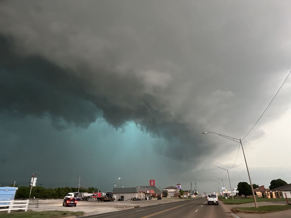
From Oklahoma north into parts of the Upper Midwest, another stormy pattern is taking shape as severe threats brew—with large hail, damaging winds and tornadoes all possible.
DANGEROUS SEVERE STORMS FIRE OFF STRONG TORNADOES, 'MONSTER' HAIL TARGETING 50M+ ACROSS 1,500 MILES
This month has been packed with active weather, bringing a parade of multi-day severe storms across the central U.S.
This past week alone has brought at least 30 confirmed tornadoes to the region—including some rated as high as EF-3—accompanied by damaging winds topping 85 mph in several areas and large hail.
The storms also triggered destructive flooding across Wisconsin and Michigan.
'CRISIS MODE:' MICHIGAN AND WISCONSIN BATTLE HISTORIC FLOODING WITH FINAL SHOT OF RAIN STILL AHEAD
Communities have been left reeling after multiple rounds of weather caused widespread structural damage, downed trees and thousands of power outages.
As a strong upper-level trough is forecast to eject out of the Rockies late this week, the dynamic system will spark a significant chance for severe storms beginning Thursday and likely persisting through the weekend.
An area of low pressure will move into the Northern Plains, dragging an associated cold front southward.
In turn, this will act as a catalyst for a broad corridor of moisture return.
SPRING SHOCKER: COLD SNAP TO FOLLOW RECORD HEAT ACROSS THE EAST NEXT WEEK
"This southerly flow will pull Gulf air northward, setting the stage for an unstable environment characterized by high dew points and plentiful storm energy," the FOX Forecast Center said.
That said, the primary focus for storms to spark on Thursday will be along a sharpening dryline expected to develop across western Oklahoma and Kansas.
With daytime heating, it will allow for discrete supercells likely to fire along this boundary by late afternoon.
All severe hazards—including large hail and tornadoes—appear possible within a corridor stretching roughly from Wichita, Kansas, south to Oklahoma City. This region is currently highlighted under a Level 2 out of 5 severe storm threat.
WHAT IS A SUPERCELL THUNDERSTORM?
The risk area expands far north of the dryline, as well, and will be driven by a plume of high storm energy forecast to stretch from North Texas all the way into Southern Nebraska just ahead of the cold front.
According to the FOX Forecast Center, while the most concentrated severe risk remains near the dryline, isolated development within the broader warm sector cannot be ruled out.
Along with that, the cold front is expected to provide the primary trigger as it moves east, likely transitioning the storm mode into a more linear complex capable of producing severe storms through the end of the week.
Stick with FOX Weather for the latest updates as the team closely monitors Friday and Saturday for the continued potential of severe storms.
What's Your Reaction?
 Like
0
Like
0
 Dislike
0
Dislike
0
 Love
0
Love
0
 Funny
0
Funny
0
 Angry
0
Angry
0
 Sad
0
Sad
0
 Wow
0
Wow
0