Rounds of snow to stretch from Four Corners to the Great Lakes, triggering Winter Weather Alerts
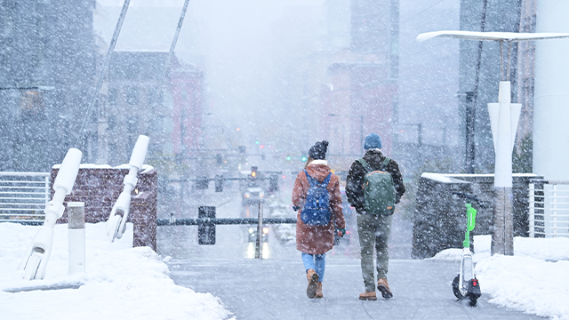
A pair of cross-country storms developing in the Four Corners and moving into the Midwest are likely to bring moderate to heavy snow from the Southwest to the Great Lakes from Wednesday through Sunday.
The first storm system will arrive on Wednesday, bringing rain and snow to higher terrain across the Four Corners and Midwest, followed by a second developing on its heels Friday that will dump more snow across the Rockies, expanding across the Midwest and Great Lakes into the weekend.
SEVERE STORM THREAT EYES MILLIONS ACROSS SOUTHEAST, DEEP SOUTH FROM POWERFUL CROSS-COUNTRY STORM
Throughout the remainder of the week, travel delays are possible across major interstates and airports, especially in the Rockies, Midwest, and parts of the South and Northeast.
As the first-round system moves through, Winter Weather Alerts have already been issued for parts of Colorado, Utah, Arizona and New Mexico.
Snow totals across the Four Corners will be around 1-3 inches from Colorado into Arizona, while higher terrains will likely see 5-8 inches of snow.
Meanwhile, the heaviest snow totals of 8-12 inches will be possible for the highest elevations of the Rockies, where cold air will remain through Saturday.
30+ STATES TARGETED BY BACK-TO-BACK CROSS-COUNTRY STORMS
According to the FOX Forecast Center, Salt Lake City will also be eyeing its first inch of snow for the season, as the city is roughly 22 inches below average for this point in the year.
The city has only recorded 0.1 inch of snow thus far, which also leaves it at the smallest amount of snow in a season to date on record, with records dating back to 1885.
By Saturday morning, Denver could also see additional snow as the storm moves east, providing a boost for ski resorts across the Rockies.
The final round will shift east out of the region and into the Plains, where portions of Oklahoma and Texas Panhandles, along with northwestern Kansas, could see a widespread 1 to3 inches of snow.
Once the first two systems move out of the Plains, it will arrive in the Upper Midwest by Thursday morning.
The FOX Forecast Center says that while this system appears to be the warmer of the two, bringing precipitation mainly as rain, the best chance for snow on Thursday evening will be across central and southern Minnesota and into northern Wisconsin, though uncertainty remains high.
PAIR OF CROSS-COUNTRY STORMS TO BRING RAIN, SNOW AND SEVERE WEATHER THREAT TO MILLIONS BY LATE WEEK
From Friday into Saturday, the second cross-country system will move into the Plains, and cooler air will surge behind the first system, creating favorable conditions for snow from the Midwest into the Great Lakes over the weekend.
The bulk of the snow is expected to arrive across Iowa, northern Illinois, and Wisconsin by Saturday morning.
As the storm strengthens, gusty winds will develop across the Upper Peninsula of Michigan, potentially leading to localized whiteout conditions Saturday night into early Sunday morning.
The highest potential for accumulating snow will likely be across areas that have already seen significant precipitation this year, including northern Wisconsin and parts of Michigan.
While some uncertainty remains in the forecast, stick with FOX Weather as the team continues to fine-tune data and update snowfall projections as the storms move through.
What's Your Reaction?
 Like
0
 Dislike
0
 Love
0
 Funny
0
 Angry
0
 Sad
0
Sad
0
 Wow
0
Wow
0
