


%20052026%20SOURCE%20Tello.jpg)


Millions at risk of large hail, damaging winds, tornadoes as multi-day severe storm threat targets Plains
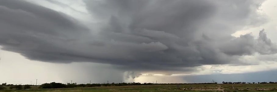
Millions across the Plains are under risk as relentless severe storms are set to roar back across the region by late week, and likely into early next week.
Targeting over a dozen states, the multi-day storm threat brings risks of heavy rain and potential flooding, lashing winds, large hail and even a few possible tornadoes.
This is all due to a shift toward a more typical severe weather pattern, which is likely to trigger storms by Saturday.
THIS IS WHAT YOU SHOULD DO IF YOU ARE DRIVING AND THERE IS A TORNADO ON THE GROUND
A Level 2 out of 5 Severe Storm Threat has been issued for parts of the region ahead of the expected storms.
And the FOX Forecast Center is keeping a close watch on Texas, Oklahoma, Kansas, Missouri, and areas stretching east into the Deep South.
MUCH-NEEDED RAIN PERSISTS ACROSS DROUGHT-STRICKEN FLORIDA AS COASTAL FLOOD THREAT BUILDS
A transition will be underway across much of the southern Plains by Friday as the atmosphere recharges for severe weather.
While scattered thunderstorms are possible during the afternoon and evening, the overall severe threat appears minimal at this time.
On Saturday, the setup becomes more favorable as an upper-level trough is expected to move east, triggering increased southwest flow across the southern and central Plains.
As this disturbance moves through, it will likely help initiate severe storms. However, the FOX Forecast Center notes that the more significant threat is expected to develop on Sunday and continue through Tuesday.
By Sunday, increased moisture and instability will fuel scattered thunderstorms during the afternoon and into the evening, followed by a stronger upper-level trough forecast to move into the southern Rockies.
"Some of these storms could become supercells, capable of producing large hail, damaging wind gusts, and a few tornadoes," the FOX Forecast Center said.
This threat extends from central and southern Texas into Oklahoma and Kansas, including cities such as Dallas, San Angelo, Oklahoma City, and Wichita.
On Monday, the storm system is expected to accelerate northward, expanding risks across a much larger area from the southern Plains into the Upper Midwest.
This is where a Level 2 out of 5 Severe Storm Threat has been issued from Midland, Texas, north into central Iowa, including major cities such as Dallas, Oklahoma City, and Kansas City.
While these storms are likely to come later in the day, they will continue overnight into Tuesday as another upper-level trough moves into the western U.S., eventually situating across the Plains by the morning.
As the system moves across the southern Plains later in the day on Tuesday, strong wind shear through multiple layers of the atmosphere combined with abundant moisture will create conditions favorable for severe storms.
LIFE-THREATENING TORNADO RIPS THROUGH PARTS OF ILLINOIS AS SEVERE WEATHER LASHES THE HEARTLAND
This round of storms will move farther south, spreading across the lower Missouri Valley into the southern Plains and potentially reaching the Louisiana Gulf Coast, where forecasts indicate all severe storm threats will be possible.
Along with severe threats, the multi-day storm stretch will bring days of heavy rain across the region that may lead to possible flash flood concerns.
APRIL WEATHER OUTLOOK: SEVERE STORMS TARGET MILLIONS AS SPRING TEMPERATURE WARMUP FINALLY NEARS
While this will help drought-stricken areas, it could lead to rising rivers and localized flooding.
Between Saturday and Tuesday, a widespread 1–2 inches of rain is expected across Texas to Wisconsin, with isolated areas in Texas, Oklahoma, and Arkansas potentially seeing 2–3 inches. A Level 1 out of 4 Flash Flood Risk begins Saturday due to the potential for heavy rainfall and flooding.
What's Your Reaction?
 Like
0
Like
0
 Dislike
0
Dislike
0
 Love
0
Love
0
 Funny
0
Funny
0
 Angry
0
Angry
0
 Sad
0
Sad
0
 Wow
0
Wow
0