


Millions across the Midwest brace for potential severe weather outbreak with threat of long-track tornadoes
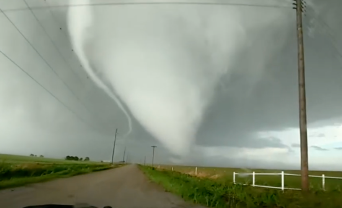
There's potential for a high-end tornado outbreak for parts of the Mid-Mississippi Valley Monday, as a broader severe weather threat targets more than 60 million people across a corridor from southern Minnesota to parts of the South, including Arkansas, northern Mississippi and northern Alabama.
Whether that outbreak materializes will be largely dependent on ongoing thunderstorm activity and how long cloud cover will remain over Missouri, Illinois and Indiana early Monday.
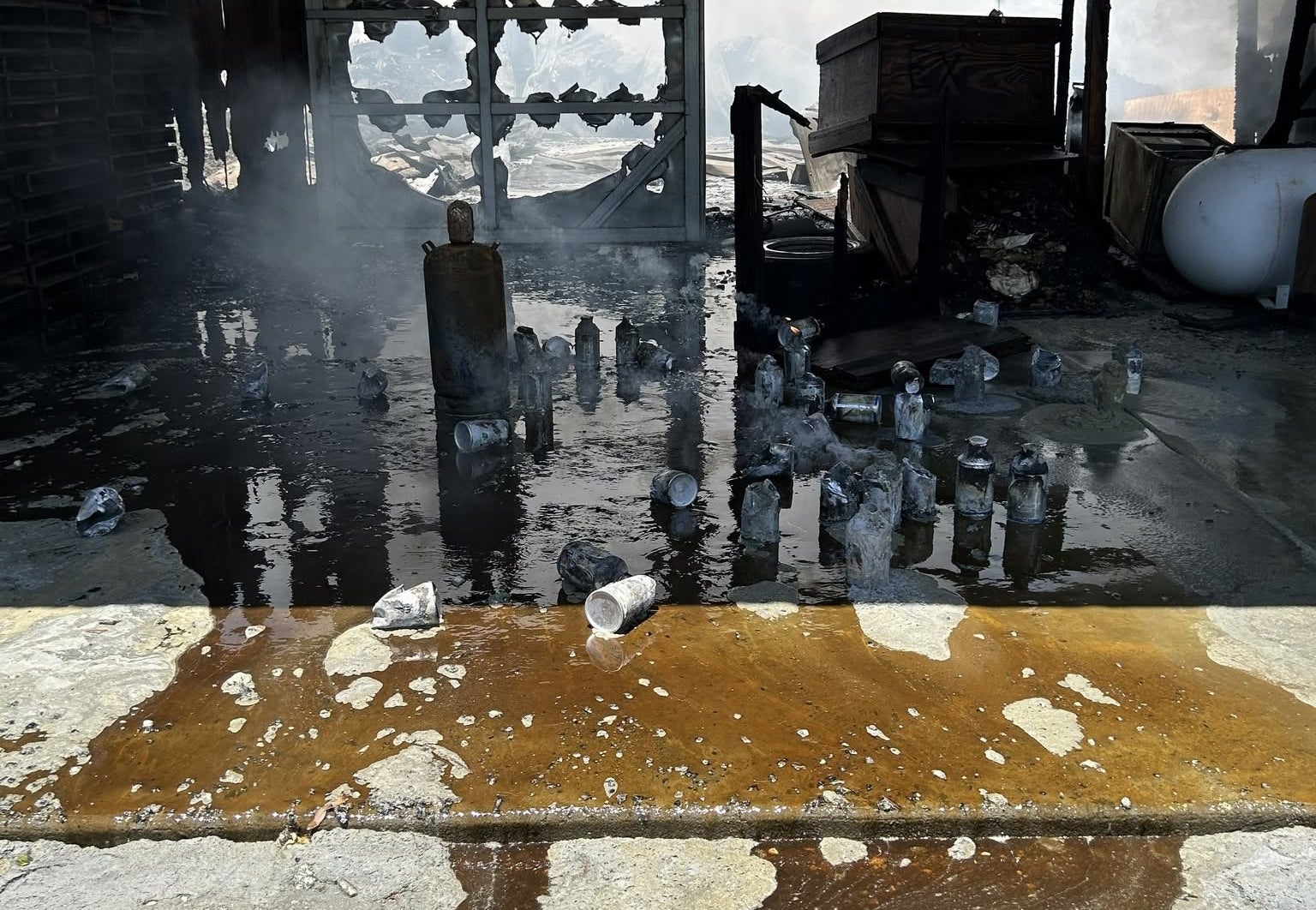
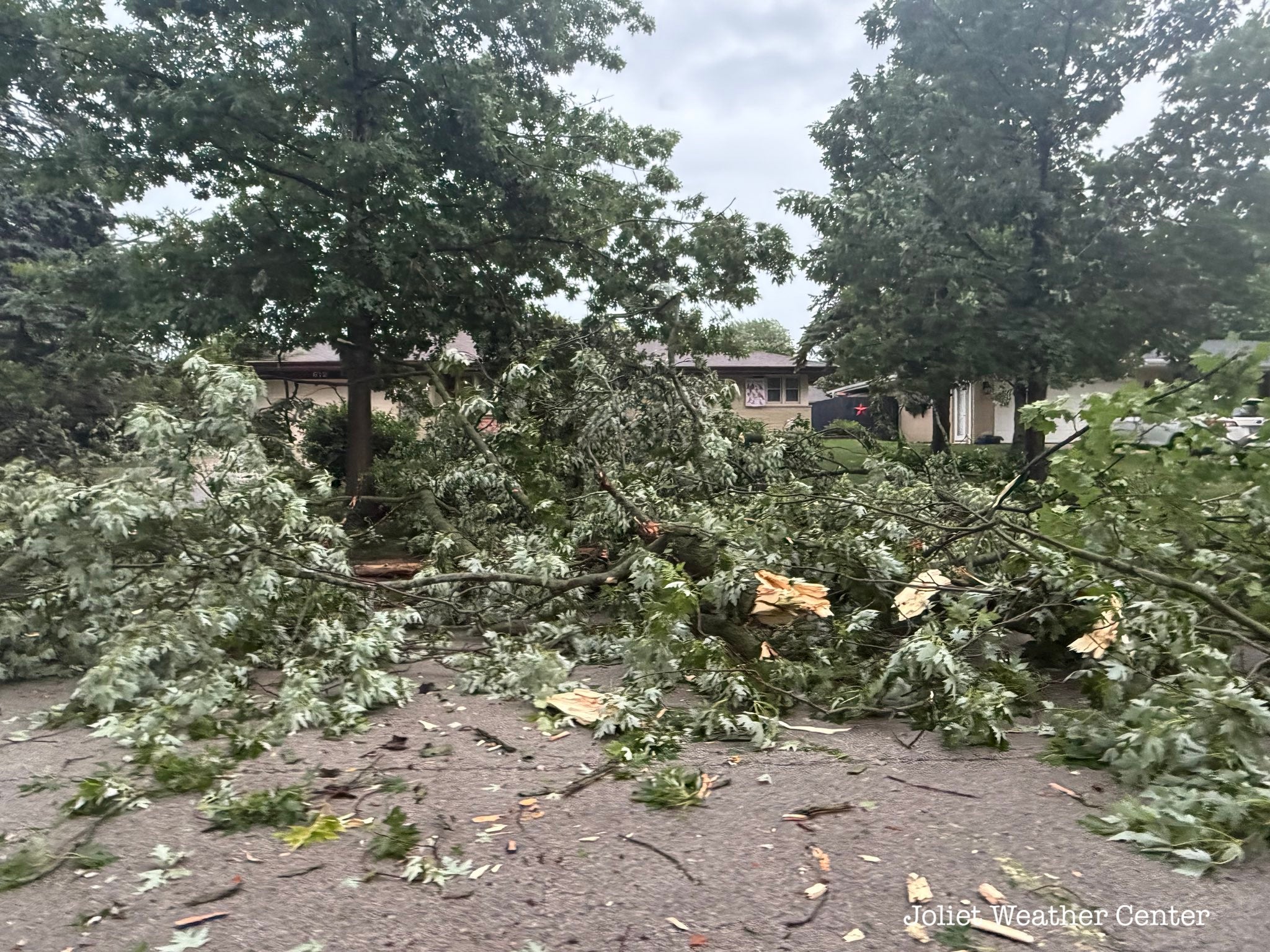
This is the latest severe weather threat in a relentless outbreak that began last Thursday, which produced a destructive EF-4 in Enid, Oklahoma, and twisters that killed at least two people in Runaway Bay, Texas late Saturday.
Sunday's severe weather threat produced large hail and damaging wind gusts across Kansas, Oklahoma and parts of North Texas.
SEE IT: DESTRUCTIVE STORMS SLAM TEXAS, LEAVING 2 DEAD AS SEVERE WEATHER SWEEPS REGION
Severe thunderstorms were ongoing early Monday, blasting through the Central Plains and the Midwest. Quarter-sized hail, heavy rain and winds gusts up to 70 mph were recorded moving through Kansas City, Missouri. Strong storms also swept through St. Louis.
The heavy rain from these storms also produced flash flooding across parts of Kansas and Missouri, with a swath of 3 to 5 inches of total rainfall through Tuesday morning.
If cloud cover clears early enough over the Midwest, the atmosphere will reload, creating an even more dangerous severe weather threat Monday afternoon.
This would create prime conditions for long-track tornadoes (EF-3+) across Missouri, Illinois, Indiana and western Kentucky. This includes the St. Louis, Springfield, Illinois, Evansville, Indiana, and Paducah, Kentucky, metro areas.
NOAA's Storm Prediction Center (SPC) has issued a Level 3 out of 5 risk of severe thunderstorms for this corridor.
In addition to the potential for long-track tornadoes, there is a Level 4 out of 5 risk of wind gusts exceeding 60 mph across this same area.
If clouds remain after noon, severe weather will likely be less intense but still pack damaging wind gusts, hail and a tornado or two.
A broader Level 2 threat covers parts of southern Wisconsin, eastern Iowa, northeastern Arkansas, and Middle Tennessee. Chicago, Indianapolis, Memphis and Nashville are all included.
Monday afternoon storms are expected to begin after 2 p.m. and last through 10 p.m.
Tuesday's severe weather forecast is also dependent on how storms develop Monday, but storms are expected to fire in the afternoon primarily across the cold front that will be draped over the Lower Mississippi Valley including, southern Missouri, Arkansas, Mississippi, northeast Alabama and Tennessee.
A Level 2 threat stretches from northeast Texas into central Kentucky.
According to the FOX Forecast Center, some of these storms could become more organized and produce large hail, damaging winds, and possibly a tornado or two.
What's Your Reaction?
 Like
0
Like
0
 Dislike
0
Dislike
0
 Love
0
Love
0
 Funny
0
Funny
0
 Angry
0
Angry
0
 Sad
0
Sad
0
 Wow
0
Wow
0