


%20052026%20SOURCE%20Tello.jpg)


Flood threat increases across Great Lakes amid heavy rainfall, rapid snowmelt

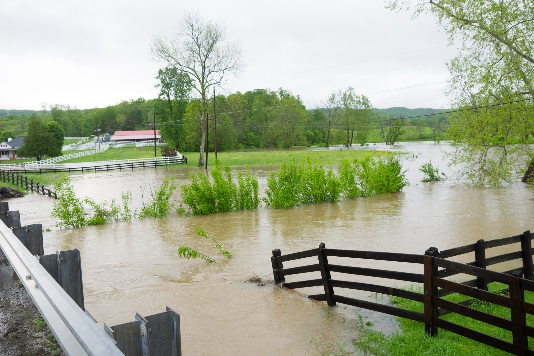
As temperatures begin to warm up, spring moisture is fueling heavy rain across the Great Lakes, where persistent downpours combined with rapid snowmelt are driving a heightened risk for flash flooding through Wednesday.
This winter season has brought a historic snowfall to portions of the region, measuring in feet.
Specifically, Marquette, Michigan, has recorded over 273 inches of snow so far this season, placing it at number two on the all-time record list.
Rivers, creeks, and streams are likely to rise rapidly as heavy rain falls over the melting, historic snowpack and frozen ground.
Meanwhile, across the Plains, saturated soils will trigger efficient runoff, significantly increasing the risk of localized flash flooding even with moderate rainfall totals.
Flood Watches have been issued for the northern half of Michigan through Wednesday morning.
The FOX Forecast Center highlights the stagnant area of high pressure anchored off the Southeast coast as the primary driver behind this week’s flash flood potential as it acts as a "moisture pump."
In turn, it funnels moisture-rich air from the Gulf to Southern Canada, setting the stage for repetitive rounds of heavy rain through the weekend.
With that, multiple storm systems will serve as the trigger for intense thunderstorms throughout the region.
This has prompted portions of the Great Lakes to face an elevated flash flood risk due to the combination of incoming rainfall and rapid snowmelt starting the week.
"The transition to warmer temperatures is aggressively melting this deep snowpack; when combined with forecasted rain totals of 2–3 inches, the risk for rapid runoff is high," the FOX Forecast Center said.
ARCTIC BLAST OVERSPREADS THE MIDWEST AND GREAT LAKES AFTER MONSTER BLIZZARD SLAMS MILLIONS
Flood Watches have been issued encompassing the northern half of Michigan through Wednesday morning, especially as most regional rivers are already at or near flood stage.
Beyond Wednesday, another round of rain moving through later in the week and into the weekend could bring an additional 1–2 inches of rain, potentially prolonging this flash flooding risk.
What's Your Reaction?
 Like
0
Like
0
 Dislike
0
Dislike
0
 Love
0
Love
0
 Funny
0
Funny
0
 Angry
0
Angry
0
 Sad
0
Sad
0
 Wow
0
Wow
0