


%20052026%20SOURCE%20Tello.jpg)


Blizzard nor'easter timeline: City-by-city breakdown of extreme snow totals, latest timing and travel impacts
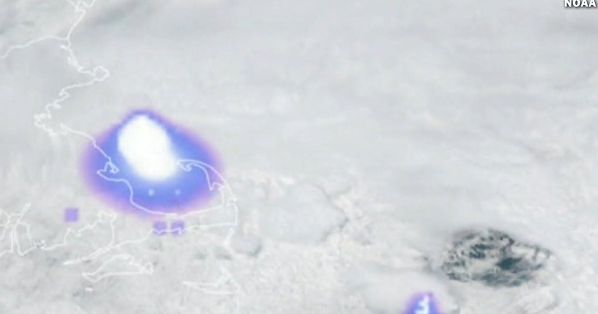
NEW YORK – Blizzard Warnings cover more than 40 million people — including Boston, New York City and Philadelphia — after a massive nor'easter, having "bombed out" off the East Coast, continues to blast the Mid-Atlantic and Northeast with intense snowfall rates and powerful wind gusts.
Governors in seven states have declared emergencies. Travel bans and restrictions are in effect across the region and more than 600,000 customers are already without power.
LIVE UPDATES: MONSTER BLIZZARD 'BOMB' PARALYZES NORTHEAST IN EXTREME SNOW, SOARING POWER OUTAGES
Read the latest timing of the historic storm by region:
The heaviest snow will start to shift to Connecticut, Rhode Island and Massachusetts and intensify through the day Monday.
Snow will waste no time piling up, accumulating between 1–3 inches per hour, according to the FOX Forecast Center.
Wind gusts could exceed 75 mph across parts of southern New England, with a potential for "jackpot" snow totals across eastern Massachusetts.
Boston had already tallied 5.2 inches of snow as of 6:00 a.m. Monday, with a wind gust of 59 mph recorded at Boston Logan International Airport.
New York's Long Island is another potential area for "jackpot" snow totals, with Islip reporting 22.5 inches of snow by 7:00 a.m. Monday.
Heavy snow will also persist through Monday, especially across Suffolk County and the easternmost parts of the island.
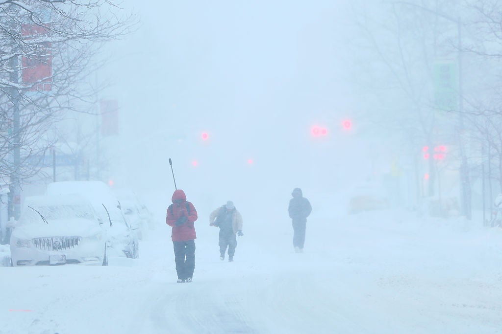
FOX Weather Storm Specialist Mike Seidel showed whiteout conditions just before 9:00 a.m.
The heaviest snow will begin to wind down over New York City around 12:00 p.m. with lighter snow lasting through 6 p.m.
Central Park tallied 16 inches of snow just before 9:00 a.m. and is quickly approaching the city's top 10 snowstorms of all time.
New York City Mayor Zohran Mamdani issued a rare citywide travel ban for non-essential vehicles across all city roads.
New York City public school students have their first full snow day since 2019.
The heaviest snow is also expected to wind down in New Jersey around 12:00 p.m. with lighter snow lingering until 5:00 p.m.
The central and southern parts of the state, as well as the Jersey shore are seeing some of the largest snow totals. Freehold recorded 22.2 inches of snow by Monday morning.
Toms River recorded more than 12 inches of snow and Atlantic City tallied more than 14 inches of snow Monday morning.
Heavy snow also reached North Jersey, with more than 11 inches recorded in Morristown.
Newark, across the river from New York City, recorded 23 inches of snow.
Snow is expected to taper over the Philadelphia area by 12:00 p.m.
Philadelphia had recorded more than 13 inches of snow by 7:00 a.m. Monday.
The worst of the storm has passed the Washington, D.C. and Baltimore areas, with both metro areas recording roughly 1-2 inches of snow.
Washington, D.C. schools are operating on a two-hour delay.
Both the Senate and House postponed key votes to Tuesday due to the nor'easter.
What's Your Reaction?
 Like
0
Like
0
 Dislike
0
Dislike
0
 Love
0
Love
0
 Funny
0
Funny
0
 Angry
0
Angry
0
 Sad
0
Sad
0
 Wow
0
Wow
0